Betsie River
In-game article clicks load inline without leaving the challenge.
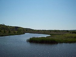
The Betsie River (/bɛtsiː/ BET-see) is a 54.0-mile-long (86.9 km) river in the U.S. state of Michigan. The river is located in the northwestern Lower Peninsula of the state, flowing into Lake Michigan at Frankfort. The river's course is mostly within Benzie County, (which takes its name from a variant pronunciation of the river), although the river rises in western Grand Traverse County and flows briefly through northern Manistee County.
The river widens to form Betsie Lake before emptying into Lake Michigan between Frankfort and Elberta. The Betsie River is a part of Michigan's Natural Rivers Program.
Etymology
The name is derived from the French la rivière aux Bec-scies, meaning river of sawbill ducks (bec-scie). A corruption of this pronunciation led to the name of Benzie County. Other alternate historical names include the following:
- Aug-sig-o-sebe
- Aux Buscies River
- Betsey's River
- Benzie River
- Black Robe River
- Gay-she-say-ing
- Riviere du Pere Marquette
- Sawbill Ducks River
- Shelldrake Ducks River
Course
While most sources indicate the river rises as the outflow of Green Lake in southwestern Grand Traverse County, some consider it navigable immediately south of US-31 from Tullers Lake into Green Lake. Another tributary of the river flows directly out of northern Duck Lake and into northern Green Lake, connecting with the aforementioned Tullers Lake Outlet. Although not considered part of the Betsie River today, older maps of the area do say so. Green Lake straddles the boundary between Grant Township on the south and Green Lake Township on the north between Karlin and Interlochen. Several nearby lakes, including Duck Lake and its tributaries, drain into Green Lake.
The river winds southwesterly from Green Lake into eastern Benzie County, and then briefly into northern Manistee County before turning northerly back into Benzie County. A dam on the river forms Homestead Pond, after which is flows mostly west and slightly north to Lake Michigan.
Drainage basin
The Betsie River drains an area of approximately 155,026 acres (627.37 km2) in three counties. The drainage basin include about 93 miles (150 km) of linear stream, 52 miles (84 km) of which is part of the mainstream.
Dams
- Homestead Dam 44°35′48″N 86°04′48″W/44.59667°N 86.08000°W/ 44.59667; -86.08000 was mostly removed in 1974 and currently acts as a lamprey barrier. It impounds little water and does not impede salmon migrations. The remains of the dam are now sometimes called "Homestead Falls". The dam was a power generating facility formerly owned by Consumers Energy.
- Grass Lake Dam, approximately 4 miles (6 km) downstream from Green Lake, forms an approximately 90-acre (36 ha) impoundment. The dam was constructed in 1951 to improve waterfowl habitat and northern pike fishing. The dam was installed by the state Wildlife Division and created a 482 acres (195 ha) waterfowl flooding.
- Thompsonville Dam was an old power dam that failed in the spring of 1989 and was subsequently removed. Prior to its removal, the dam posed a barrier to salmon migration. Salmon and trout have access to the entire mainstream of the river, even above the Grass Lake Dam.
Bridges
Below is a list of public crossings of the Betsie River:
| Route | Type | Municipality | County | Location |
|---|---|---|---|---|
| M-22 (Frankfort Avenue) | State highway | Benzonia Township | Benzie | 44°37′13.1″N 86°13′18.1″W/44.620306°N 86.221694°W/ 44.620306; -86.221694 |
| Betsie Valley Trailway (west) | Paved trail | 44°37′09.2″N 86°13′13.5″W/44.619222°N 86.220417°W/ 44.619222; -86.220417 | ||
| River Road (west) | County road | Crystal Lake Township | 44°37′05.9″N 86°10′04.0″W/44.618306°N 86.167778°W/ 44.618306; -86.167778 | |
| River Road (east) | County road | Benzonia Township | 44°37′05.2″N 86°07′24.0″W/44.618111°N 86.123333°W/ 44.618111; -86.123333 | |
| Grace Road | County road | 44°36′16.0″N 86°06′44.3″W/44.604444°N 86.112306°W/ 44.604444; -86.112306 | ||
| US 31/M-115 (Benzie Highway) | State highway | 44°36′02.2″N 86°07′24.0″W/44.600611°N 86.123333°W/ 44.600611; -86.123333 | ||
| M-115 (west) | State highway | Weldon Township | 44°33′26.3″N 86°03′12.3″W/44.557306°N 86.053417°W/ 44.557306; -86.053417 | |
| County Line Road | County road | Weldon/Springdale township | Benzie/Manistee line | 44°30′52.0″N 86°02′40.6″W/44.514444°N 86.044611°W/ 44.514444; -86.044611 |
| Psutka Road | County road | Springdale Township | Manistee | 44°29′46.4″N 86°01′47.7″W/44.496222°N 86.029917°W/ 44.496222; -86.029917 |
| Kurick Road | County road | 44°30′05.3″N 85°58′45.2″W/44.501472°N 85.979222°W/ 44.501472; -85.979222 | ||
| M-115 (east) | State highway | 44°30′26.9″N 85°58′06.3″W/44.507472°N 85.968417°W/ 44.507472; -85.968417 | ||
| Lindy Road | County road | Weldon Township | Benzie | 44°31′13.8″N 85°57′41.5″W/44.520500°N 85.961528°W/ 44.520500; -85.961528 |
| Wolf Road | County road | 44°31′43.1″N 85°56′55.8″W/44.528639°N 85.948833°W/ 44.528639; -85.948833 | ||
| Betsie Valley Trailway (east) | Paved trail | 44°31′48.6″N 85°56′51.6″W/44.530167°N 85.947667°W/ 44.530167; -85.947667 | ||
| King Road | County road | 44°32′32.1″N 85°56′32.9″W/44.542250°N 85.942472°W/ 44.542250; -85.942472 | ||
| South Thompsonville Highway | County road | Colfax Township | 44°37′47.2″N 85°56′16.9″W/44.629778°N 85.938028°W/ 44.629778; -85.938028 | |
| South Carmean Road | County road | 44°33′19.6″N 85°55′05.8″W/44.555444°N 85.918278°W/ 44.555444; -85.918278 | ||
| Wallin Road | County road | 44°34′13.7″N 85°53′35.0″W/44.570472°N 85.893056°W/ 44.570472; -85.893056 | ||
| Nostwick Road | County road | 44°34′23.4″N 85°53′16.7″W/44.573167°N 85.887972°W/ 44.573167; -85.887972 | ||
| South Reynolds Road | County road | 44°34′28.8″N 85°52′40.2″W/44.574667°N 85.877833°W/ 44.574667; -85.877833 | ||
| Betsie River Road | County road | Grant Township | Grand Traverse | 44°35′34.7″N 85°47′48.0″W/44.592972°N 85.796667°W/ 44.592972; -85.796667 |
| Diamond Park Road | County road | Green Lake Township | 44°37′59.5″N 85°46′55.2″W/44.633194°N 85.782000°W/ 44.633194; -85.782000 | |
| J. Maddy Parkway | County road | 44°38′29.2″N 85°46′02.2″W/44.641444°N 85.767278°W/ 44.641444; -85.767278 | ||
| Birch Road | County road | 44°39′14.5″N 85°45′04.6″W/44.654028°N 85.751278°W/ 44.654028; -85.751278 | ||
| US 31 | State highway | 44°39′30.9″N 85°44′59.7″W/44.658583°N 85.749917°W/ 44.658583; -85.749917 |
Tributaries
- Betsie Lake 44°37′42″N 86°13′47″W/44.62833°N 86.22972°W/ 44.62833; -86.22972
- Crystal Lake Outlet 44°37′32″N 86°08′18″W/44.62556°N 86.13833°W/ 44.62556; -86.13833 Crystal Lake Cold Creek 44°37′47″N 86°05′46″W/44.62972°N 86.09611°W/ 44.62972; -86.09611 in Beulah
- Rice Creek 44°36′19″N 86°06′51″W/44.60528°N 86.11417°W/ 44.60528; -86.11417
- Dair Creek 44°33′05″N 86°03′15″W/44.55139°N 86.05417°W/ 44.55139; -86.05417
- Little Betsie River 44°32′01″N 85°56′44″W/44.53361°N 85.94556°W/ 44.53361; -85.94556
- Pickerel Creek 44°35′29″N 85°50′25″W/44.59139°N 85.84028°W/ 44.59139; -85.84028 Twin Lake 44°34′19″N 85°49′46″W/44.57194°N 85.82944°W/ 44.57194; -85.82944 Upper Twin Lake 44°34′19″N 85°49′17″W/44.57194°N 85.82139°W/ 44.57194; -85.82139
- Grass Lake 44°36′30″N 85°51′03″W/44.60833°N 85.85083°W/ 44.60833; -85.85083
- Mud Lake 44°34′31″N 85°47′55″W/44.57528°N 85.79861°W/ 44.57528; -85.79861
- Green Lake 44°36′41″N 85°47′03″W/44.61139°N 85.78417°W/ 44.61139; -85.78417 Bridge Lake 44°38′21″N 85°47′07″W/44.63917°N 85.78528°W/ 44.63917; -85.78528 Tullers Lake 44°39′15″N 85°46′43″W/44.65417°N 85.77861°W/ 44.65417; -85.77861 Cedar Hedge Lake 44°40′12″N 85°47′04″W/44.67000°N 85.78444°W/ 44.67000; -85.78444 Mud Lake 44°38′36″N 85°45′28″W/44.64333°N 85.75778°W/ 44.64333; -85.75778 Duck Lake 44°37′53″N 85°44′42″W/44.63139°N 85.74500°W/ 44.63139; -85.74500 Horton Creek Brigham Creek 44°37′18″N 85°43′42″W/44.62167°N 85.72833°W/ 44.62167; -85.72833 Mason Creek 44°37′51″N 85°43′26″W/44.63083°N 85.72389°W/ 44.63083; -85.72389 Weidenhamer Swamp 44°37′35″N 85°36′10″W/44.62639°N 85.60278°W/ 44.62639; -85.60278 Tonawanda Lake 44°39′03″N 85°45′07″W/44.65083°N 85.75194°W/ 44.65083; -85.75194 Ellis Lake 44°39′47″N 85°44′54″W/44.66306°N 85.74833°W/ 44.66306; -85.74833 Saunders Lake 44°40′17″N 85°43′56″W/44.67139°N 85.73222°W/ 44.67139; -85.73222