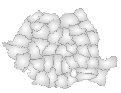
Dolj County
In-game article clicks load inline without leaving the challenge.
Dolj County (Romanian pronunciation: [dolʒ] ⓘ; originally meant Dol(no)-Jiu, "lower Jiu", as opposed to Gorj (upper Jiu))[citation needed] is a county (județ) of Romania on the border with Bulgaria, in Oltenia, with the capital city at Craiova.
Demographics
In 2011, the county had a population of 660,544 and a population density of 89/km2 (230/sq mi).
| Year | County population |
|---|---|
| 1948 | 615,301 |
| 1956 | 642,028 |
| 1966 | 691,116 |
| 1977 | 750,328 |
| 1992 | 761,074 |
| 2002 | 734,231 |
| 2011 | 660,544 |
| 2021 | 599,442 |
Geography
This county has a total area of 7,414 km2 (2,863 sq mi).
The entire area is a plain with the Danube on the south forming a wide valley crossed by the Jiu River in the middle. Other small rivers flow through the county, each one forming a small valley. There are some lakes across the county and many ponds and channels in the Danube valley. 6% of the county's area is a desert.
Neighbours
- Olt County to the east.
- Mehedinți County to the west.
- Gorj County and Vâlcea County to the north.
- Bulgaria – Vidin Province to the southwest, Montana and Vratsa provinces to the south.
Economy
Agriculture is the county's main industry. The county has a land that is ideal for growing cereals, vegetables, and wines. Other industries are mainly located in the city of Craiova, the largest city in southwestern Romania.
The county's main industries:
- Automotive industry – Ford has a factory.
- Heavy electrical and transport equipment – Electroputere Craiova is the largest factory plant in Romania.
- Aeronautics
- Chemicals processing
- Foods and beverages
- Textiles
- Mechanical parts and components
There are two small ports on the shore of the Danube river – Bechet and Calafat.
People
- Corneliu Baba
- Tudor Gheorghe
- Mircea Mihail Ghiorghiu[ro]
- Alexandru Macedonski
- Titu Maiorescu
- Amza Pellea
- Gheorghe Popescu
- Doina Ruști
- Francisc Șirato
- Marin Sorescu
- Nicolae Titulescu
- Ion Țuculescu
- Nicolae Vasilescu-Karpen
- Mihai Viteazul
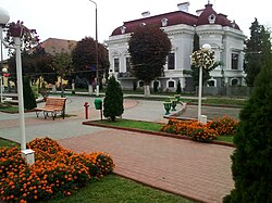
Tourism
Major tourist attractions:
Politics
The Dolj County Council, renewed at the 2024 local elections, consists of 36 councilors, with the following party composition:
| Party | Seats | Current County Council | |||||||||||||||||||||
|---|---|---|---|---|---|---|---|---|---|---|---|---|---|---|---|---|---|---|---|---|---|---|---|
| Social Democratic Party (PSD) | 21 | ||||||||||||||||||||||
| National Liberal Party (PNL) | 9 | ||||||||||||||||||||||
| Alliance for the Union of Romanians (AUR) | 3 | ||||||||||||||||||||||
| Save Romania Union (USR) | 1 | ||||||||||||||||||||||
| People's Movement Party (PMP) | 1 | ||||||||||||||||||||||
| Force of the Right (FD) | 1 |
Administrative divisions


Dolj County 3 municipalities, 4 towns and 104 communes
Municipalities
Towns
Communes
- Afumați
- Almăj
- Amărăștii de Jos
- Amărăștii de Sus
- Apele Vii
- Argetoaia
- Bârca
- Bistreț
- Botoșești-Paia
- Brabova
- Brădești
- Braloștița
- Bratovoești
- Breasta
- Bucovăț
- Bulzești
- Călărași
- Calopăr
- Caraula
- Cârcea
- Cârna
- Carpen
- Castranova
- Catane
- Celaru
- Cerăt
- Cernătești
- Cetate
- Cioroiași
- Ciupercenii Noi
- Coșoveni
- Coțofenii din Dos
- Coțofenii din Față
- Daneți
- Desa
- Dioști
- Dobrești
- Dobrotești
- Drăgotești
- Drănic
- Fărcaș
- Galicea Mare
- Galiciuica
- Gângiova
- Ghercești
- Ghidici
- Ghindeni
- Gighera
- Giubega
- Giurgița
- Gogoșu
- Goicea
- Goiești
- Grecești
- Întorsura
- Ișalnița
- Izvoare
- Leu
- Lipovu
- Măceșu de Jos
- Măceșu de Sus
- Maglavit
- Malu Mare
- Mârșani
- Melinești
- Mischii
- Moțăței
- Murgași
- Negoi
- Orodel
- Ostroveni
- Perișor
- Pielești
- Piscu Vechi
- Plenița
- Pleșoi
- Podari
- Poiana Mare
- Predești
- Radovan
- Rast
- Robănești
- Rojiște
- Sadova
- Sălcuța
- Scăești
- Seaca de Câmp
- Seaca de Pădure
- Secu
- Siliștea Crucii
- Șimnicu de Sus
- Sopot
- Tălpaș
- Teasc
- Terpezița
- Teslui
- Țuglui
- Unirea
- Urzicuța
- Valea Stanciului
- Vârtop
- Vârvoru de Jos
- Vela
- Verbița
Historical county
Historically, the county was located in the southwestern part of Greater Romania, in the southwest part of the historical region of Oltenia. Its capital was Craiova. The interwar county territory comprised the central and southwestern part of the current Dolj county. It was bordered to the north with by the counties of Gorj and Valcea, to the west by Mehedinți County, to the east by Romanați County, and to the south by the Kingdom of Bulgaria.
Administration

The county was originally divided into six administrative districts (plăși):
- Plasa Amaradia, headquartered at Melinești
- Plasa Bârca, headquartered at Bârca
- Plasa Calafat, headquartered at Calafat
- Plasa Gângiova, headquartered at Gângiova
- Plasa Ocolul, headquartered at Ocolul
- Plasa Plenița, headquartered at Plenița
Subsequently, four districts were created in place of two of the prior districts (Plasa Bârca and Plasa Gângiova):
- Plasa Bechet, headquartered at Bechet
- Plasa Brabova, headquartered at Brabova
- Plasa Filiași, headquartered at Filiași
- Plasa Segarcea, headquartered at Segarcea
Population
According to the 1930 census data, the county population was 485,149 inhabitants, ethnically divided as follows: 96.7% Romanian, 0.5% Jews, 0.3% Germans, 0.3% Hungarians, as well as other minorities. From the religious point of view, the population was 98.4% Eastern Orthodox, 0.7% Roman Catholic, 0.5% Jewish, as well as other minorities.
Urban population
In 1930, the county's urban population was 91,788 inhabitants, comprising 90.2% Romanians, 2.4% Jews, 2.2% Romanies, 1.7% Germans, 1.3% Hungarians, as well as other minorities. From the religious point of view, the urban population was composed of 92.7% Eastern Orthodox, 3.1% Roman Catholic, 2.5% Jewish, 0.7% Lutheran, 0.3% Calvinist, 0.3% Greek Catholic, as well as other minorities.