Dvaravati
In-game article clicks load inline without leaving the challenge.
Dvaravati refers to a cultural and political network of early historic polities that flourished in the present-day central Thailand from approximately the 6th to the 11th century; however, archaeological evidence suggests that the cultural developments associated with Dvaravati began several centuries earlier, often described as a Proto-Dvaravati phase. It is tentatively regarded as a successor to the polity known in Chinese sources as Lang-chia or Lang-ya-hsiu. Chinese Buddhist accounts from the mid-7th century describe a Buddhist kingdom called To-lo-po-ti, located west of Isanapura (Cambodia), east of Sri Ksetra (Burma), and north of Pan Pan. Its northern frontier bordered Jiā Luó Shě Fú (迦逻舍佛), identified with Canasapura, which covered the upper Mun-Chi basin in present-day northeastern Thailand and Si Thep in the Pa Sak basin in central Thailand. Dvaravati is recorded to have sent embassies to the Chinese court in 583, around 605–616, in 638, 640, 643, 647, and 649.
The term Dvaravati also denotes a broader cultural and artistic sphere associated with a loose conglomeration of Mon principalities rather than a centralized state. Archaeological and historical evidence suggests that Mon communities, possibly involved in maritime trade, contributed to the emergence of Dvaravati culture in the Chao Phraya valley by the early centuries CE. This development appears to have followed a transitional “Proto-Dvaravati” phase during the 2nd–5th centuries, associated with early principalities such as Chin Lin in the western plains and Tou Yuan to the east.
The location of Dvaravati’s early political center remains debated. Proposed centers include Ayojjhapura (Si Thep), Sambuka (Nakhon Pathom), and Avadhyapura (Si Mahosot[th]). By the mid-7th century, political prominence appears to have shifted toward Lavo's Lavapura, following the incorporation of Tou Yuan in 647. Some scholars place this transition later, in the 10th–11th centuries, after the decline of Si Thep, while others regard Lavapura as a distinct polity—later known as the Lavo Kingdom—that nevertheless lay within the Dvaravati cultural and political sphere.
The decline of Dvaravati was likely the result of overlapping regional pressures rather than a single event. These included the expansion of Angkor from the lower Mekong basin between the 11th and 13th centuries, northward campaigns by Tambralinga under King Sujita in the mid-10th century, which reportedly included the seizure of Lavo, political instability and warfare within Angkor in the early 11th century that affected the Menam valley, and Pagan incursions into central Thailand during the 11th–12th centuries. According to Jean Boisselier, although Dvaravati lost influence over eastern centers such as Lavo by the 10th–11th centuries, Mon principalities in the western plains likely persisted into the early 12th century, before coming under brief Angkorian influence during the reign of Jayavarman VII (r. 1181–1218). Thereafter, the region entered the Xiān period, marked by the emergence of Suphannabhum, Phrip Phri, and Ayodhya, the latter reasserting control over Lavo by the 14th century.
History


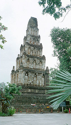
Dvaravati culture was characterized by the presence of moated urban settlements, among which U Thong, located in present-day Suphan Buri Province, is generally regarded as the earliest. Other major sites include Nakhon Pathom, Pong Tuek[de], Si Thep, Khu Bua, and Si Mahosot[th], among others. The term "Dvaravati" derives from coins bearing the Sanskrit inscription śrī dvāravatī. In Sanskrit, dvāravatī literally means "that which has gates".Further evidence for the political and geographical significance of Dvaravati is provided by the Wat Phra Ngam Inscription N.Th. 21, discovered in 2019 at Wat Phra Ngam in Nakhon Pathom province and dated to the 6th century CE. This inscription refers to three regional cities—Śrīyānaṁdimiriṅga or Śrīyānaṁdimiriṅgapratipura, Hastināpurī, and Dvāravatī—suggesting that Nakhon Pathom, where the inscription was found, likely functioned as the central place of Dvāravatī.
The traditional chronology of Dvaravati is mainly based on the Chinese textual account and stylistic comparison by art historians. However, the results from excavations in Chan Sen and Tha Muang mound at U-Thong raise questions about the traditional dating. Newly dated typical Dvaravati cultural items from the site of U-Thong indicate that the starting point of the tradition of Dvaravati culture possibly dates as far back as 200 CE. Archaeological, art historical, and epigraphic (inscriptions) evidence all indicate, however, that the main period of Dvaravati spanned the seventh to ninth centuries. Dvaravati culture and influence also spread into Isan and parts of lowland Laos from the sixth century onward. Key sites include Mueang Fa Daet in Kalasin Province, Sema[th] in Nakhon Ratchasima Province, and many others.
The earliest known epigraphic reference to "Dvaravati" occurs in the Wat Chanthuek Inscription (K.1009), discovered in Pak Chong, Nakhon Ratchasima Province. The text is composed in Sanskrit and inscribed in the Pallava script, and is conventionally dated to the 5th century CE. It records a queen of Dvaravati who instructed her daughter to sponsor the dedication of a Buddha image.
Proto-Dvaravati: 1st – 5th centuries
This period predates the 6th century CE, and is generally placed between the 1st and 5th centuries CE, although some scholars argue for a narrower chronological range, extending only from the 4th to the 5th centuries. Archaeological sites associated with this phase are primarily concentrated in the western Menam valleys. These include the unmoated settlement of Pong Tuek[de] (พงตึก), which has been suggested as one of the five capitals of Tun Sun; the moated city of Mueang Uthong, which has sometimes been identified as the center of Chin Lin; and the site of Ban Don Ta Phet[th].
Archaeological evidence indicates human occupation in the region from at least c. 1000 BCE, during the Neolithic period. From approximately 900 BCE to 200 BCE, material remains suggest increasing participation in maritime exchange networks, possibly linking the area with communities in present-day Taiwan, the Philippines, and Vietnam. Settlements continuity and expansion are observable during the Bronze and Iron Ages, and by the 1st to 2nd centuries CE, contacts appear to have extended further, including interactions with South Asia, China, and countries to the west. Artifacts recovered from several sites have been interpreted as indicating participation in exchange networks associated with Funan, although the nature and extent of their political relationship remain debated.
In the eastern plain, the Sup Champa site (เมืองโบราณซับจำปา) in present-day Lopburi Province has yielded evidence suggesting the emergence of a complex society by around 500 BCE, although the site remains insufficiently excavated, and its broader regional role has yet to be clearly established. By the 5th to 6th centuries CE, Mueang Uthong appears to have retained its central role, while Nakhon Pathom shows evidence of concurrent growth and increasing regional significance. From approximately the 6th to the 10th centuries CE, Nakhon Pathom is widely regarded as a supra-regional center of the Dvaravati cultural sphere, alongside other major centers such as Si Thep in the eastern plain.
Origin traditions and migration narratives
Prior to the Dvaravati period, the lower Menam Basin is described in the Tai Yuan's Legend of Singhanavati as Lava-rāṣṭra (ลวรัฐ; lit.'country or land of Lawa people'). The territorial interface between this polity and Yonok of Tai Yuan is situated in the region around the mouth of the Ping River. This depiction aligns with Gordon Luce’s hypothesis that the Lawa once occupied much of central Thailand, extending as far south as Lopburi. Luce’s argument is based on a perceived toponymic connection between Lavapuri of the seventh-century Lavo Kingdom, and the ethnonym Lawa.
The Legend of Singhanavati further records sustained interactions between Tai Yuan and Lawa or Lua groups beginning with the formation of the Yonok Kingdom, as the first ruler of Yonok, Singhanavati[th], consolidated his authority through the subjugation of several pre-existing settlements, some of which are implicitly associated with Lawa populations. Dynastic intermarriage is likewise attested: the third monarch of Yonok, Achutraraj (พญาอชุตราช), is said to have taken a princess of the Lawa of Doi Tung as his principal queen consort, and their son subsequently succeeded to the Yonok throne. The Lawa polity at Wiang Phang Kham also served as the political and military base for Singhanavati monarchs during a campaign to regain control of Yonok after it was seized by Umongkasela in the late 4th century.
In the late Yonok period, Chaiyasiri is said to have faced an invasion by the Mon kingdom of Thaton. As recorded in the Singhanavati tradition, this conflict precipitated a large-scale southward migration in 444 CE, during which Chaiyasiri is said to have led approximately 100,000 households into the upper Chao Phraya River Basin, where he is credited with founding a settlement at present-day Kamphaeng Phet. Despite the prominence of this migration narrative, no demonstrable relationship has been established between these accounts and the earliest epigraphic attestation of the ethnonym syam, which appears in a Funan inscription K.557, dated to 611 CE. Drawing on a distinct documentary tradition from the same period, Chinese sources dating from the late 6th to early 7th century, the Tang Huiyao and the Cefu Yuangui, describe the existence of an independent polity known as Duō Miè, which, although not territorially extensive, was noted for its relatively large population, and seemingly contiguous with the western border of Tou Yuan, centered at either Lopburi or Si Mahosot[th], of Dvaravati. This migration narrative also influenced later reconstructions of Tai-speaking migrations, which commonly posit two principal routes: one from the northwest, associated with the polity later known as Möng Mao, and another from the northeast, linked to the region of Muang Then.
Early Western accounts from the Ayutthaya period provide retrospective evidence that King Phrom of the Singhanavati dynasty, father of Chaiyasiri, was regarded as Ayutthaya’s primordial monarch. Authors such as Jeremias van Vliet, Guy Tachard, and Simon de La Loubère report that this belief was widely held and reinforced by court traditions under the reigns of Maha Chakkraphat, Prasat Thong, and Narai, which traced Ayutthayan royal lineage to Phrom. This belief has also shaped modern interpretation on the Burmese chronicle Hmannan Yazawin. The chronicle records that in 1056 the Gywans of Ayoja (or Arawsa), described as residing to the southeast of Thaton, mounted a military expedition against the Mon center located there. George Cœdès identified Ayoja with Ayodhya or Siam, whereas Francis H. Giles proposed that the Gywans were descendants of the Tai Yuan.
Early Dvaravati: 6th – 9th centuries

The pre-Dvaravati communities appear to have become increasingly dense, and larger, undergoing continuous development until the construction of major religious monuments in the early to middle Dvaravati period, dated approximately from the first half of the 7th century to the first half of the 9th century. This phase is often characterized as one of regional political competition, particularly between two supra-regional centers: Nakhon Pathom in the western valley and Si Thep in the eastern plain. However, following reported Chenla incursions during the 7th century, several Dvaravati polities are thought to have become involved in wider regional conflicts.
During this period, it has been proposed that an interdynastic marriage occurred during the 7th century between a Tai Yuan princess and the Mon prince of Lavo, an alliance that is said to have produced King Sai Thong Som. Moreover, the Laotian Legend of Khun Borom claims that Khun Borom, whose historicity David K. Wyatt tentatively placed around the 7th century, ordered his nine sons to establish their own domains in different regions. One of these sons, Khoun Kôm (ขุนกม or ลกกม), is said to have founded Indaprasthanagara, a polity which the Ayutthaya Testimonies place to the east of Sankhaburi, in the Phraek Si Racha historical region. Another son, Ngua In (งัวอิน), is claims in the same tradition to have founded Ayutthaya.
The aforementioned attributions, however, are difficult to reconcile with the account preserved in the Tai Yuan Legend of Singhanavati, which states that Indaprasthanagara was already in existence during the reign of Phrom of Yonok (r. 379–438). The chronicle records that Phrom repelled the forces of a vassal ruler of Umongasela and forced them southward toward the region of present-day Kamphaeng Phet; these defeated groups are said to have subsequently fled to Indaprasthanagara in the Chao Phraya Basin. The same text further identifies this area as part of Lava-rāṣṭra, a designation introduced earlier in the narrative. Significantly, the area corresponding to modern Ayutthaya prior to the 9th–10th centuries is described as a low-lying swamp, subject to seasonal monsoonal flooding, with water levels rising by approximately four meters during the rainy season relative to the dry-season baseline, rendering the area unsuitable for settlement.
Rivalry among Dvaravati polities
Rivalries between regional centers such as Nakhon Pathom and Si Thep have been suggested by some scholars, and may be sporadically reflected in later local traditions, which have commonly been interpreted as forms of regional competition, although scholarly interpretations vary. The earliest narratives of conflict are preserved in several versions of the Legend of Nakhon Chai Si and the Legend of Phra Praton Chedi. These traditions recount that Siddhijaya, originating from Manohana—a toponym identified with Ayojjhapura in the Pali chronicles Ratanabimbavaṃsa and Jinakalamali; this city has in turn been equated with Si Thep—relocated to the Nakhon Pathom region and established his authority around 590 CE. According to these accounts, Siddhijaya came into conflict with a pre-existing ruler, Kakabhadra, a struggle said to have ended in Siddhijaya’s military victory. Siddhijaya’s authority is speculated to have extended into the early 7th century, based on a record of a Dvaravati tributary mission to the Chinese court in 616 CE, listed under the name Tou-he (投和國; Dvaravati), whose ruler is recorded as Pu-xie-qi-yao (脯邪乞遙), a name that has been phonetically compared with Siddhijaya. In contrast, Kakabhadra is described in traditional account as having retained authority in parts of the region until 641 CE, when he was succeeded by his elder son, Kalavarnadisharaja. It has therefore been suggested that Kakabhadra and Siddhijaya may represent the same historical figure under different names.

Later tradition holds that around 629 CE, a group of Brahmins from Nakhon Pathom received an order to establish a new urban settlement in what is now Lopburi, south of Si Thep. The city is said to have been completed in 648 CE, with Kalavarnadisharaja, son of Kakabhadra, enthroned as its inaugural ruler—an event regarded in these sources as marking the establishment of the Lavo Kingdom. Kalavarnadisharaja’s reign is characterized in the Northern Chronicle as a period of territorial expansion, extending inland as far as Chiang Saen in northern Thailand, where he is said to have exercised political influence and established dynastic relations with Tai Yuan monarchs. Notably, however, these traditions contain no explicit account of his relations with Si Thep, which, during the 6th to 7th centuries, was ruled by a line of monarchs attested in the Ban Wang Pai inscription (K.978) and is later linked in the Jinakalamali to Rajadhiraj, who is described there as a king of Ayojjhapura. This founder narrative, however, is irreconcilable with the account preserved in the Cāmadevivaṃsa, which states that in 647 CE—one year prior to Kalavarnadisharaja’s supposed accession—Lavo was already ruled by Navaratna (นพรัตน์), a king without a biological heir who adopted Camadevi as his daughter, and who subsequently married her to Ramaraj, a prince of Ramburi identified by some Thai scholars with Kalavarnadisharaja. The existence of an established polity at Lavo is further corroborated by Xuanzang’s account, which refers to Lavo as Luó-wō-guó (罗涡国) as early as 629. Some sources further propose an earlier foundation date, as early as 538 CE.
After the last tribute mission attributed to Dvaravati, referred to in Chinese records as the Tou-he kingdom (投和國), during the Zhenguan period (貞觀, 627–649) of Emperor Taizong of Tang, political authority in the Menam basin appears to have undergone substantial reconfiguration. On the basis of Chinese sources, Tatsuo Hoshino interprets that political power had already shifted significantly around 665 CE, when Pú jiā yuè mó, associated with Si Thep, is said to have consolidated authority over both the Si Thep and Nakhon Pathom regions. This consolidation was not, however, permanent: within the same century, the Jinakalamali recounts a narrative concerning Anuruddha, a 7th-century ruler of Arimaddanapura (often associated with Nakhon Pathom), who is said to have launched a military campaign against Ayojjhapura/Si Thep and successfully captured its ruler, Manohanaraj, bringing him to Nakhon Pathom. Anuruddha is further portrayed in the Northern Chronicle as having extended political pressure toward Indaprasthanagara in the Phraek Si Racha region.
Toward the late 7th century, the Legend of the Arhat (ตำนานนิทานพระอรหันต์) records that Balidhiraja, eldest son of Kalavarnadisharaja of Lavo and ruler of Sukhothai, marched south into the western valley, overthrew the incumbent ruler, and installed his youngest son, Sai Thong Som—said to be of mixed Mon–Tai ancestry—as the new monarch, while his elder son, Balipatijaya, succeeded Kalavarnadisharaja at Lavo around 700 CE. Following this phase of political transition, a ruler named Padumasuriyavamsa is said to have emerged at Indaprasthanagara in the central Menam Valley by 757 CE. Later traditions describe his authority as encompassing Lavo and Sukhothai, and extending eastward into the Korat Plateau as far as Mueang Talung (เมืองตลุง or ตะลุมดอ) in present-day Prakhon Chai district; several later Siamese monarchs subsequently claimed descent from him. Additional material evidence may also be relevant here: a terracotta Buddha image dated to the 8th century and discovered at Mueang Uthong bears the name of a King Maratha (มะระตา), although the inscription provides no further details. While this may point to the existence of another named ruler within the wider Dvaravati sphere, the available evidence is insufficient to determine how Maratha or his polity related to other contemporary centres, whether as a subordinate, ally, or rival.
During the early 9th century, the Ratanabimbavaṃsa records that Indaprasthanagara was besieged by Adītaraj of Ayojjhapura (Si Thep) following the demise of its great ruler. The Si Thep line nevertheless appears to have remained an important regional power, as attested by Bhagadatta, whose reign is dated from 859 CE by the Śrī Canāśa Inscription (K.949). This dynasty is said to have endured until 949 CE, when it was reportedly brought to an end following incursions from Angkor. A possible ethnographic continuity with these events is preserved among the Nyah Kur people of Thep Sathit District, immediately adjacent to Si Thep in southern Phetchabun Province. This community speaks an archaic Mon-related language containing Khmer loanwords attesting to prior contact with Khmer-speaking populations, and their oral traditions recount that ancestors were displaced following Khmer seizure of their settlement and subsequently migrated to the surrounding highland margins. Their present distribution spanning the borders of Phetchabun, Lopburi, Chaiyaphum, and Nakhon Ratchasima has been associated by scholars with the expansion of Angkorian influence during the 10th–11th centuries CE, a period consistent with the Angkorian incursions recorded in contemporary sources. Archaeological evidence from the surrounding area further corroborates this association, with Khmer ceramics and Chinese Song dynasty celadon wares recovered in the highland zone indicating human activity during the 10th–12th centuries CE.
Following the campaign of Adītaraj of Ayojjhapura against Indaprasthanagara, a narrative recounted in the Northern Chronicle and the Ratanabimbavamsa relates that Bhūpati (ภูบดี), a ruler of Vajraprākārapura (วชิรปาการปุระ; modern Kamphaeng Phet) who maintained good relations with both Ayojjhapura and Ngoenyang Chiang Rai, sent his son—whose regnal name is not recorded—to rule Lavo Lavapura, a polity previously noted to have been under Indaprasthanagara since the reign of Padumasuriyavamsa. Vajraprākārapura itself is likewise noted in the Ayutthaya Testimonies as having been founded by a descendant of Padumasuriyavamsa. A few dacades later, later traditions recorded in the Jinakalamali and Cāmadevivaṃsa introduce Uchitthaka, a cakravartin described as having lost the capital of Lavapura to Sujita of Tambralinga in 927 CE, during a campaign linked to conflicts involving Haripuñjaya; he subsequently marched northward, seized Haripuñjaya, and ruled there until 930 CE. More broadly, local ruling lineages in the upper, central, and western regions appear to have persisted until the late 10th–11th centuries, before increasingly facing external pressures and invasions from Pagan, Tambralinga, Angkor, Chola, and Ngoenyang Chiang Saen.
Khorat Plateau and Middle Mekong region
The Khorat Plateau and the Middle Mekong region, situated east of the core Dvaravati centers, does not appear to have formed an integral part of the Dvaravati political network. Instead, it developed as a loosely connected landscape of small fortified and moated settlements. Building upon the site inventories compiled by Thiva Supajanya and Srisakra Vallibhotama[fr], Charles F. Keyes argued that local traditions, particularly the legend of Phadaeng Nang Ai and the Tamnan Fa Daet Song Yang (ตำนานฟ้าแดดสงยาง), preserve the names of several early settlements in the region. Among these was Mueang Fa Daet Song Yang, the first site in northeastern Thailand identified as “Dvaravati” by H. G. Quaritch Wales and traditionally attributed to the foundation of Chao Fa Ra-ngum in 621 CE. Keyes nevertheless cautioned that the labels “Dvaravati,” “Mon,” and even “Buddhist” may be misleading when applied uncritically to the Khorat Plateau. The traditions instead depict a politically fragmented landscape composed of largely autonomous muang, some exercising authority over subordinate settlements and others remaining independent. These traditions further reveal the coexistence of Buddhist practices alongside fertility cults and local spirit beliefs influenced by Hindu deities.
This interpretation is broadly consistent with epigraphic and Chinese evidence, both of which suggest that the Khorat Plateau was divided among numerous small polities during the 6th to 9th centuries. Several inscriptions discovered throughout the region mention local rulers or nobles engaged in religious activities. In the Phimai region, the Sanskrit Phimai Inscription No. 1 (K.1000), dated to the 7th to 8th centuries, refers to a Buddhist ruler named Sauryavarman. Separate evidence is provided by the Hĭn K‘ôn inscriptions (K.388 and K.389), which mention a Buddhist noble named Nrpendradhiphativarman together with his father, who bore a similar name. Elsewhere, the Don Mueang Toei[th] inscription records King Pravarasena of Śaṅkhapura; the Wat Ban Waan inscription (ศก. 13) mentions King Srimanya; and the Wat Pa Nong Peng inscription refers to King Śrīmānarājā. Significantly, the latter inscription describes Śrīmānarājā's reign as a period of political turmoil, providing valuable insight into the unstable political conditions of the region. Collectively, these inscriptions demonstrate the existence of multiple local polities prior to the emergence of Angkorian authority to the south.
During roughly the same period, corresponding to the reign of Mahendravarman of Chenla (r. 600–615), parts of the Khorat Plateau may have come under temporary Chenla influence. Several victory inscriptions attributed to Mahendravarman have been found across the Mun–Chi Basin, extending from Dong Mueang Aem in present-day Khon Kaen Province to the Phimai region and the mouth of the Mun River in modern Ubon Ratchathani province. Earlier interpretations regarded these inscriptions as evidence of Chenla administration over the conquered territories through a vassal system. However, as the inscriptions merely proclaim military victories without indicating permanent political control, Michael Vickery argued that they do not demonstrate direct Chenla authority beyond the Dongrek Mountains. Rather, Mahendravarman's campaigns appear to have been temporary military expeditions whose political impact was limited, as subsequent regional inscriptions make no reference to rulers from the Tonlé Sap Basin for several centuries thereafter.

A more substantial connection with Chenla may have emerged during the reign of Isanavarman I (r. 616–637). Chinese records mention a polity named Bhīmapura under his authority, which some scholars have identified with Vimayapura (Phimai). Other interpretations suggest that polities in the central Khorat Plateau and upper Pa Sak Basin established dynastic ties with Isanavarman's court. This hypothesis derives from Chinese accounts describing the states of Zhu Jiang and Can Ban as allies of Chenla through marriage connections. While much of the Khorat Plateau appears to have lain within the overlapping spheres of influence of Chenla and Dvaravati, the northeastern part of the plateau—encompassing present-day Nakhon Phanom, Sakon Nakhon, and Bueng Kan provinces in Thailand, together with Bolikhamxai and Khammouane provinces in Laos—was recorded in Chinese sources as forming part of a Tang administrative division known as Changzhou Prefecture (長州 or 裳州) during the early 7th century, comprising two districts. Hoshino has proposed that the early Tai polities of Gǔ Láng Dòng (古郎洞) and Jūn Nà Lú (君那盧) were situated within this region. However, Changzhou is not mentioned again in the Chinese records after the emergence of Wen Dan, although the relationship between the two remains unclear.
From the mid-7th century onward, following the reign of Isanavarman I, Chinese sources suggest a weakening of Chenla's political influence in the Khorat Plateau and adjacent regions, where several distinct polities began to appear as independent actors in the historical record. Among them was Zhān Bó, often associated with the archaeological site of Champasri, which dispatched a tributary mission to China in 657 and may have emerged through the merger of the polities known in other Chinese texts as Zhān Guo (瞻國) and Bó Guo (博國). Another polity, Pó Àn (婆岸), mentioned in the New Book of Tang, has been tentatively identified with the area around modern Phon District. Drawing upon these records, Hoshino has argued that Zhān Bó, Po An, and several states in the Menam Valley and along the Cham coast formed part of a trans-Mekong trade confederation and they differed from typical Dvaravati polities that dominated the coastal area. Following the reign of Jayavarman I (r. 657–681), scholars have proposed that Wen Dan, a polity located in the central Khorat Plateau, separated from Chenla sometime between 681 and 707 before sending its first recorded tributary mission to China in 717. George Cœdès identified this polity with Mūladeśa, a toponym attested in the K.187 inscription. Chinese records further state that, in 755, Wen Dan assisted a native Nghean lord in the wars against the Chinese governor at Jiaozhou, which they won, conquering Jiaozhou, after which the native lord enthroned himself as Hei-ti (lit.'Black Emperor'); Hoshino suggests that this lord was probably a Tai or a Hmong. Woodward has likewise suggested that Wen Dan's influence extended beyond the Khorat Plateau into the Si Thep and northern Tonlé Sap regions, where several pre-Angkorian Buddhist and architectural remains have been interpreted as reflecting connections with the Dvaravati cultural sphere.
From the 9th century onward, references to the Khorat Plateau become considerably rarer, with the last recorded tributary mission of Wen Dan to China occurring in 799. Scholars generally suggest that both the plateau and much of present-day Laos entered the so-called “Java Period” during the 9th century, contemporaneous with the emergence of Angkor in the Tonlé Sap Basin. Because the toponym Java also figures prominently in narratives concerning the foundation of Angkor, its identification has become a subject of considerable scholarly debate. The term has variously been interpreted as referring to the island of Java, Cham-related polities on the Southeast Asian mainland, or other maritime powers active in the region. The issue is further complicated by inscriptions of Jayavarman VII (r. 1181–1218) that mention a “King of Yavana” alongside a “King of Java” and two kings of Champa within the same historical context, suggesting that these designations referred to distinct political entities whose exact identification remains unresolved.
Dvaravati–Chenla relations

Dvaravati polities in the Chao Phraya Basin have been proposed to have maintained dynastic connections with the polities of the Tonlé Sap Basin and the Mekong Delta since the Funan period. George Cœdès suggested that Chakravartin, the father of Prathivindravarman of Si Thep mentioned in the Wang Pai Inscription (K.978), may have been identical with Rudravarman, the last ruler of the Candravaṃśa dynasty of Funan. However, following the siege of Funan's capital by the brothers Bhavavarman I and Mahendravarman I of the Suryavaṃśa dynasty of Chenla, Rudravarman is said to fled to Champa, while members of his lineage dispersed to other polities such as Pan Pan.
Claude Jacques has proposed an alternative interpretation, identifying Chakravartin with Mahārājādhirāja Śrī Devanika, who is described in the Devanika Inscription (K.365), dated to the early 5th century, as having come from a distant land. Jacques suggested that Devanika ruled from a center corresponding to Si Thep and dispatched princes to govern several cities along the trans-Mekong trade route. These cities may have included Dong Mueang Aem in modern Khon Kaen province, Dong Muang Toey[th] in present-day Yasothon province, and Vat Phou in southern Laos. The lineage associated with Vat Phou was later identified as the founding line of Chenla. However, this identification has been disputed by Zakharova.
George Cœdès and Claude Jacques initially dated the Wang Pai Inscription to the mid-6th century and identified the Bhavavarman mentioned in the inscription with Bhavavarman I of Chenla. However, Claude Jacques later reinterpreted the inscription and proposed that the Bhavavarman mentioned in the text was a local ruler of Si Thep rather than the Chenla monarch. This interpretation corresponds with the argument of Kangwon Katchima, who suggested that the epigraphic style indicates a date after 637 CE. Under this interpretation, the Bhavavarman mentioned in the inscription may have been Bhavavarman II or another local ruler associated with Si Thep rather than Bhavavarman I, whose political authority has been suggested to be limited to regions south of the Dângrêk Mountains. The interpretation of Kangwon Katchima was later supported by Anurak Depimai, who also argued that the Bhavavarman mentioned in the inscription could not have been Bhavavarman II, since the Wat Kud Tae Inscription identifies Bhavavarman II as the son of Isanavarman I.

During the reign of Isanavarman I of Chenla (r. 616–637), attempts were made to extend influence into the Menam Basin, particularly toward the Tou Yuan Kingdom, whose principal center has been proposed to correspond to modern Lopburi or Si Mahosot[th]. The conflict is described as having concluded with a dynastic marriage between a princess of Chenla and a prince of Dvaravati. This marriage is also recorded in local fable of the Chao Phraya Valley. The offspring of this lineage, Harshavarman, whose name appears in the Copper Plate Inscription of Mueang Uthong, later became the ruler of that polity. During the same period, Chenla under Isanavarman I also established royal marriages with Champa and with other polities influenced by Dvaravati, including Zhu Jiang and Can Ban. As a result of these dynastic connections, artistic traditions in the Menam Basin, particularly in the western region, show influences from both Chenla and Champa. Dvaravati is also recorded to have established a dynastic connection with a polity in the upper Mun Basin through the marriage of a Dvaravati princess to the ruler of that polity, as recorded in the 5th-century Wat Chanthuek Inscription (K.1009).
Following the death of Isanavarman I, his successor Bhavavarman II (r. 639–657) is recorded in the Wat Kud Tae Inscription as engaging in military conflict with Dvaravati Sambuka, commonly identified with modern Nakhon Pathom. Tatsuo Hoshino has argued that these conflicts involved several polities, including the kingdoms referred to in Chinese sources as Qiān Zhī Fú (later known as Gē Luó Shě Fēn), Xiū Luó Fēn, and Gān Bì, which together are described as mobilizing approximately 50,000 elite troops. During these conflicts, Tou Yuan—previously the target of Chenla expansion—was recorded in 647 as a vassal of Dvaravati. In the following year, the Lavo Kingdom was established or reestablished by Kalavarnadisharaja (r. 641–700) of Dvaravati Nakhon Pathom. During the reign of Bhavavarman II of Chenla, Dvaravati polities from the western Menam Basin are described as extending their influence eastward as far as Muang Phai (เมืองไผ่) in modern Aranyaprathet district, identified with Jyesthapura, the former seat of Bhavavarman II between 637 and 639. This period of intensified contact between Chenla and Dvaravati polities coincides with a notable cluster of references to syam as a toponym or ethnonym in pre-Angkorian inscriptions, appearing in K.557 (611 CE), K.79 (639 CE), K.127 (683 CE), K.154 (685 CE), and K.904 (713 CE), where it designates both enslaved persons and at least one landholding official. Scholars have interpreted syam at this stage as probably a toponym referring to some location in the lower Chao Phraya Basin. These references are not attested following the fragmentation of Chenla in the early 8th century.
During this transitional period, the region northwest of the Tonlé Sap Basin, particularly south of the Dângrêk Mountains and around present-day Battambang Province, is described as fragmenting into four polities that sent embassies to China after separating from Chenla. By the 720s, this region is described as coming under the influence of another polity known as Wen Dan, which is associated with the Dvaravati cultural sphere. Archaeological evidence includes Buddhist boundary stones (Bai sema) discovered on Mount Kulen and dated to the 8th century, as well as other pre-Angkorian structures displaying features associated with Wen Dan. Based on this evidence, Hiram W. Woodward suggested that the northern Tonlé Sap region during this period was not under the authority of Lower Chenla but instead formed part of the sphere of Wen Dan, which maintained close relations with, or exercised authority over, Si Thep. Population movements from this region toward Si Thep in the early 8th century are also described as occurring under the auspices of Wen Dan.
Following the aforementioned fragmentation, the Tonlé Sap polities were reunified and, in the early 9th century, established their principal center further north in the Angkor region. Jayavarman II (r. 780–850), ruler of Lower Chenla and later regarded as the founder of the Angkorian monarchy, is recorded as having re-established relations with polities in the Mun–Chi basins, where the former ally Zhu Jiang was located, and as having encountered Dvaravati Si Thep in the Menam–Pa Sak valleys. Woodward has further proposed that Jayavarman II defeated Wen Dan during this period, after which the remaining Dvaravati-associated Wen Dan region in the Chi valley entered the Javā era. Archaeological and textual data suggest that by the early 8th century, the political predominance of Dvaravati had entered a phase of decline. Subsequently, Angkor, under the reign of Rajendravarman II (r. 944–968) successfully conquered Si Thep in 946. Thereafter, Si Thep declined and was abandoned by approximately the 13th century, contemporaneously with the rise of the Sukhothai and Ayutthaya kingdoms. Another Dvaravati center, Lavapura of Lavo, came under Angkor influence from the 10th century, and fell under Angkorian authority in 1005 during the reign of Suryavarman I (r. 1002-1050). During his reign, Angkor also reasserted control over several polities that had been lost to Dvaravati since the 8th century, including Jyesthapura in present-day Sa Kaeo Province and Candhrapura in present-day Chanthaburi Province, while also taking over the former Dvaravati vassal Avadhyapura[th] in what is now Prachin Buri Province.
Si Thep dominance
Following the fragmentation of Chenla in the early 8th century, Si Thep emerged as the principal surviving regional power in the Menam basin. Chinese records identify a polity known as Qiān Zhī Fú (千支弗), centered at Si Thep in the eastern-central Menam plain, as having sent its first tributary mission to the Chinese court around 656–661 CE during the reign of Emperor Gaozong of Tang. The same sources describe the polity as maintaining a standing force of approximately 20,000 soldiers and exercising authority over a territory traversable in roughly one month from east to west, with Duō Mó Cháng (多摩長) recorded as its northern neighbor. Tatsuo Hoshino proposes that Duō Mó Cháng should be located within the fluvial zone of present-day northern Thailand, subsequently associated with the Lan Na sphere, which would place Qiān Zhī Fú's northern boundary in the upper Menam basin.
By the 8th century, Chinese sources record a further designation Gē Luó Shě Fēn (歌羅舍分), described therein as lying to the west of Dvaravati. Scholars have tentatively identified Gē Luó Shě Fēn with Qiān Zhī Fú, in part on the basis of its phonological correspondence with Jiā Luó Shě Fú (迦逻舍佛), a Sanskrit toponym which Tatsuo Hoshino proposes was centered at Si Thep, with Mueang Sema[de] functioning as a subordinate regional center rather than the principal seat. Under this interpretation, the shift from Qiān Zhī Fú to Gē Luó Shě Fēn is read as reflecting an expansion of Si Thep's sphere of influence to encompass much of the lower Chao Phraya valley, including the former Dvaravati center at Nakhon Pathom, while Lavo in the east is thought to have remained within the older Dvaravati network. Hoshino has further proposed that Qiān Zhī Fú represented an early Siamese polity, one of several proto-Siamese states that prospered through trans-Mekong trade networks connecting Champa in the east with the Menam basin in the west. This identification is supported in part by the phonetic resemblance between qiān (千) and the later term xiān (暹), used in Chinese and Đại Việt sources to designate the Siamese polities of the lower Chao Phraya basin.
During this period, Indaprasthanagara, after stabilizing under Padumasuriyavamsa and his successor, appears to have entered a period of prolonged instability, with later traditions recording a rapid succession of short-lived reigns. The chronicle further describes the city as having suffered a major flood and a subsequent military attack — attributed by some scholars to Si Thep — following which much of the remaining population is said to have dispersed. Epigraphic evidence nonetheless attests to a continuous ruling lineage at Si Thep through the 9th and early 10th centuries, as recorded in the Śrī Canāśa Inscription (K.949), which lists Bhagadatta and his successors as rulers from 859 CE onward. This configuration persisted until the intensification of external pressures in the 10th century brought about the end of Si Thep's regional dominance following its conquest by Angkor in 946 CE.
Late Dvaravati: 9th – 11th centuries


Economic and archaeological transformations
Some scholars date this period to the 9th to 10th centuries CE, while other studies indicate that the Dvaravati cultural horizon extended into the 11th century. During this time, changes in the economic conditions of communities in the western Menam valley are recorded, and external trade connections with the Tang dynasty, conducted through routes associated with the Maritime Silk Road, are attested. In the same period, the Menam valley polities are recorded as experiencing several external political incursions, events that are associated in the sources with the end of the Dvaravati period in the 11th century. Archaeological surveys in the area surrounding the former center at Mueang Uthong indicate low settlement density during this phase, and the site is recorded as having been abandoned in the 12th century. Evidence of trade between Uthong and Tang China during the 9th to 10th centuries CE is also documented. Against this backdrop of contraction in earlier Dvaravati centers, the early 10th-century conquest of the lower Menam basin by Tambralinga marked a shift in regional dynamics: Nakhon Pathom—identified as Mevilimbangam—entered a period of maritime trade prosperity linked to the emergence of Srivijaya, albeit with limited political influence, while Lavo simultaneously rose as a regional center under Angkorian control beginning in the 11th century.
Regional power reconfiguration
Following a brief conquest of Lavo by Tambralinga in 927 and the annexation of Si Thep by Angkor in 949, political authority over the Sukhothai region, mentioned in the Northern Chronicle, appears to have passed to Haripuñjaya monarchs in the 950s. During this period, several Dvaravati polities experienced external incursions or displacement. According to the Yonok Chronicle[th], Suphannaphum, situated in the western Menam valley, is recorded as having suffered an assault that compelled its two princes to flee northward into Haripuñjaya territory in the 930s, while a series of ultimately unsuccessful Tambralinga campaigns launched from Lavo attempted to advance toward Haripuñjaya. These disruptions coincided with a northward relocation of the political center of the early Siamese polity led by Sudhammaraja from the central Menam valley to Phitsanulok in 937, as mentioned in the Ayutthaya Testimonies. By the mid-10th century, Lavo itself is said to have come under the authority of Indaprasthanagara, a transition associated with the tradition of Sricandradhipati, described as a commoner from Lavo who rose to become ruler of Sukhothai in 959. Later in the same century, Ipoia Sanne Thora Thesma Teperat is said to have transferred his seat of power from Indaprasthanagara to Lavo's Lavapura.
By circa 1001–1005, Lavo had fallen under Angkorian authority during the reign of Suryavarman I, prompting the Siamese monarch Visnuraja at Phitsanulok to relocate southwestward to Phetchaburi. In 1052, the Angkorian ruler at Lavo was defeated by a king of Haripuñjaya, who installed his younger brother Chandrachota as the new ruler; shortly thereafter, the Siamese ruler Srisimha returned from Phetchaburi to the central Menam valley. The Burmese chronicle Hmannan Yazawin records that in 1056 the Gywan warriors — described as descendants of the Thai Yuan and located by the chronicle in a southeastern land called Ayoja — marched against the Thaton kingdom, then in the process of annexation by Pagan, an episode corroborated by Burmese inscriptions from the Arakan Pagoda in Mandalay. The chronicles of Thaton likewise mention an attack by the Krom, with both ethnonyms likely referring to the Khom people. George Cœdès proposed that Ayoja corresponds to Ayudhya or Siam.
Concurrent developments at Angkor further shaped the regional configuration. The Mahidharapura lineage, associated with the Phimai region, lost control of the Angkor and Preah Vihear regions to Suryavarman I around 1010 amid a succession struggle, prompting the rival claimant Jayavirahvarman to withdraw toward Phimai. Interpretations of the Preah Vihear inscription further suggest that members of the ruling elite were subsequently removed from authority, with some scholars proposing a displacement toward what is now upper northeastern Thailand. A century later, however, the same lineage is attested as having reestablished its regional influence through dynastic alliances with the Tai Lueang (ไทเลือง) royal house, forged through the marriage of Pha Mueang to Sukhara Mahadevi[km], a princess associated with the court of Jayavarman VII.
These northern dynastic developments intersected with events in the upper Menam valley. The Northern Chronicle records that during the reign of Suvacanaraja of Mueang Chaliang — commencing around the 1050s — a coalition of Tai Yuan mueang, led by Śrīdharmatripiṭaka (ศรีธรรมไตรปิฎก) of Ngoenyang Chiang Saen, advanced southward into the upper Menam valley. Although the conflict was ultimately resolved through negotiation, a dynastic alliance was established whereby Suvacanaraja gave his only daughter in marriage to Śrīdharmatripiṭaka, who is also credited with reconstructing Phitsanulok. In the lower basin, the death of Narai of Ayodhya in 1087, reportedly without an heir, triggered a two-year succession conflict among nine royal houses, culminating in the victory of Phra Chao Luang. Against this backdrop, Śrīdharmatripiṭaka is said to have relocated from Chiang Saen to Phitsanulok in 1106, where he governed until his death. Although scholarly interpretations generally assign these campaigns to a later period, the original text assigns an earlier date of around 1500 BE (957/58 CE).
The interdynastic union between the houses of Śrīdharmatripiṭaka and Suvacanaraja is said to have produced two princes, the elder of whom, Kesariraja, subsequently became ruler of Lavo, with his reign generally dated by scholars to have begun around 1106. Through a further interdynastic marriage, a son of Kesariraja, Duangkrian Krishnaraja (ดวงเกรียนกฤษณะราช), is reported to have wed a Xiān princess, a daughter of Phra Chao Luang (r. 1089–1111) of Ayodhya, extending the network of dynastic connections between the northern Tai Lueang houses and the Siamese polities of the lower basin. In a later phase, from the late 12th to the mid-14th century, the upper eastern Menam valley — particularly the lower Nan River basin encompassing parts of present-day Uttaradit and Phitsanulok province — appears to have come under the authority of a Tai Lueang royal house traditionally traced to Sri Naw Nam Thum, before this authority was ceded to the Xiān line of Si Inthrathit during the reign of Maha Thammaracha I, who is said to have relocated the capital from Sukhothai to Phitsanulok in 1349.
Power networks of Khorat Plateau and Middle Mekong
Pagan expansion and final decline
As a consequence of the 1056 incursion by the Gywan, it has been suggested that Anawrahta of the Pagan Kingdom extended his authority into the lower Menam basin, during which Dvaravati Nakhon Pathom may have been destroyed around 1058. This expansion ultimately resulted in the submission of Lavo. These successive disruptions appear to have led to the destruction of several urban centers, and Nakhon Pathom seems to have undergone severe depopulation between the 11th and 12th centuries. Earlier, in the late 1020s to the early 1030s, Nakhon Pathom, already militarily weakened by recurrent conflicts between Haripuñjaya and Lavo in the early 10th century, was reportedly raided during the Southeast Asian campaign of the Chola ruler Rajendra I.
The Northern Chronicle further records that the Pagan noble Kar Tayy exercised political authority over the Suphannaphum–Mueang Uthong region from approximately 1081 to 1121, after which Mueang Uthong was abandoned and Suphannaphum to have lacked a ruler. Another passage of the chronicle recounts a Pagan invasion of the newly refounded Ayodhya in 1087; although Ayodhya is said to have prevailed, its ruler, Narai I, is recorded as having died in the same year. Around the same period, the Legend of Nakhon Si Thammarat[th] refers to a foreign ruler, Sri Dharmasokaraja I, said to have originated from Pagan's Hanthawaddy, who governed Indaprasthanagara–Lavo in the east–central Menam valley until around 1117 before moving southward to establish his rule at Nakhon Si Thammarat; this interval also witnessed the relocation of the Xiān royal seat under Surindraraja northward from Phraek Si Racha to Chai Nat.
Viewed in conjunction, the aforementioned accounts suggest a prolonged phase—spanning roughly a century—of Pagan political penetration into the Menam valley, a reconstruction that is consistent with the early 13th-century Chinese text Zhu Fan Zhi, which notes that Chenla bordered Pagan to the west. Following Sri Dharmasokaraja I’s departure, Angkor reasserted control over Lavo and initiated a renewed phase of political and cultural expansion into the Menam basin, a development consistent with the testimony of the Banteay Chhmar Inscription, which recounts that Jayavarman VII and his son marched against an invasion from the west, and the Prasat Tor Inscription, which further records that Jayavarman VII prevailed over the monarch of the west in 1189/90 or 1195/96.
Post-Dvaravati: 12th – 13th centuries


Regional transformation
The 12th and 13th centuries mark a transitional phase following the decline of Dvaravati, characterized by political fragmentation and competition among several newly emergent centers in the Menam and Mae Klong River basins. Many of these polities later developed into historically attested Siamese states, including Phrip Phri, Suphannaphum, Suvarnapura, Sukhothai, and Ayutthaya. During this period, former Dvaravati supra-regional centers lost much of their earlier prominence. Of the two principal centers, Si Thep remained under Angkorian authority but experienced a gradual decline in political and economic significance and is generally considered to have been abandoned by around the 13th century. Nakhon Pathom, formerly a major center in the western plain, and its associated site of Khu Bua, appear to have experienced substantial depopulation, while local authority increasingly focused on the Mae Klong River basin, particularly at the sites of modern Ratchaburi and Mueang Sa Kosi Narai (เมืองสระโกสินารายณ์). These two sites have respectively been identified with Jaya Rajapuri and Sambukapattana as mentioned in the Preah Khan Inscription (K.904), both exhibit clear Angkorian cultural influence, as does the nearby site of Pong Tuek[de].


Within this shifting regional configuration, the principal power in the western Menam valleys appears to have been centred at Mueang Sing, located in the present-day Mueang Sing Historical Park, while authority in the eastern plain was based at Lopburi. The latter alternated between Angkorian control and periods of local autonomy. Both centres are identified in the Preah Khan Inscription as Sri Jayasimhapuri and Lavodayapura, respectively. Nevertheless, the extent of Angkorian political authority over the polities of the Menam valleys from the period associated with Jayavarman VII onward remains debated. One argument derives from the distribution of hospitals (arogyasala) and fire houses (vahnigrha) built along roads extending from Angkor toward major regional centers, none of which lie further west than Prachin Buri. In this context, the reference in the Preah Khan Inscription to the dispatch of the image Jayabuddhamahanatha to at least six polities in the Menam valley may be more appropriately interpreted as an act of cultural diplomacy rather than as evidence of direct political control.
Archaeological evidence from the ruins of Mueang Sing in present-day Kanchanaburi, the westernmost province of Thailand, further reflects the complex nature of Angkorian interaction in the Menam valleys. Although the site's architecture and artistic features closely resemble the Bayon style associated with the reign of Jayavarman VII, archaeologists have suggested that only the principal craftsmen or architectural specialists may have originated from Angkor or the Angkorian regional center at Lavodayapura, while much of the remaining construction was likely undertaken by local artisans. This interpretation is further supported by architectural irregularities observed at the site, including a lack of symmetry and proportional coherence, as well as apparent inconsistencies in the placement of certain structures. Moreover, inscriptions engraved on the sandstone bases supporting sculptural elements are written in Late Angkorian script and language, suggesting that portions of the monument may have been completed or modified after the reign of Jayavarman VII. Archaeological excavations have also uncovered a limited quantity of Chinese ceramics dating to the Ming period alongside Sukhothai wares; however, the quantity recovered remains insufficient to demonstrate sustained occupation following the Angkorian period.
During this period, several polities were recorded by Chinese merchants between 1103 and 1115, during the Song dynasty. A number of these have been tentatively identified as being located in the lower Menam basin, including Zhēn Lǐ Fù (真里富), Róng Lǐ (茸里), Luó Hú (罗斛), and Xún Fān (浔番). It is possible that conflicts among these polities occurred during this transitional phase. Epigraphic studies further suggest increasing linguistic diversity in the lower Menam basin during this transitional period. Several scholars have identified lexical elements of Thai language embedded within inscriptions otherwise composed in Pali, Sanskrit, and Old Khmer, including the Dong Mae Nang Mueang inscription (K.766) dated to 1167 CE, the Phra Phuttharup Nak Prok inscription (K.995) dated to 1213 CE, and the Mueang Sing inscription (กจ. 4), tentatively dated to the 13th–14th centuries. The script forms employed in these inscriptions have also been noted to differ markedly from those found in inscriptions associated with the sphere of Jayavarman VII, particularly those from the Phimai, Surin, Buriram and Angkor regions. The latest of these inscriptions records the name of a local ruler, Phraya Chaiyakon (พฺรญาไชยกร). Comparable evidence of linguistic development may also be found in an original section of the Pre-Ayutthaya legal manuscript Phra Aiyakan Betset, which contains an internal date corresponding to 1224 CE and is written entirely in Thai, exhibiting archaic linguistic features and phraseology reminiscent of the Sukhothai Ram Khamhaeng Inscription.
Emergence of Siamese polities
Later historical traditions and epigraphic interpretations attest to the emergence of several regional ruling lineages in the Menam valley during the 12th century. Following Sri Dharmasokaraja I's relocation to Nakhon Si Thammarat in 1117, his successor Sri Dharmasokaraja II is recorded — in interpretations of the Dong Mè Nang Mưo'ng Inscription (K.766), dated to 1168 CE — as having regained control over Lavo in 1157 and extended authority northward toward present-day Nakhon Sawan. He is further described as consolidating his hold over the central Menam valley by securing the loyalty of Dhanyapuri, a polity mentioned in the same inscription.
Around the same period, later traditions describe a northward shift of several Siamese political centres. The Ayutthaya Testimonies record that Suryaraja relocated to Kamphaeng Phet in 1156, while Pra Poa Noome Thele Seri — according to Du Royaume de Siam and the Instructions Given to the Siamese Envoys Sent to Portugal (1684) — moved to the Nakhon Thai–Sukhothai region in 1155, and his younger brother Uthong I is mentioned in the Northern Chronicle as having established himself at Mueang Chaliang. Subsequent sources indicate that these Siamese rulers later moved to reclaim their footing in the lower western Menam valleys, including the Suphannaphum–Phrip Phri–Jayasimhapuri region during the 1160s, where Jatiraja (ชาติราชา) is described as exercising authority at Jayasimhapuri, and where Pra Poa Noome Thele Seri subsequently succeeded him in the 1170s. The line associated with Suryaraja, by contrast, expanded northward and forged alliances with Tai chiefdoms, laying the political foundation for what is conventionally identified as the Sukhothai Kingdom.
The Nakhon Si Thammarat Chronicle[th] corroborates this broader picture, recording military activity in the lower river valleys involving Sri Dharmasokaraja and his extension of authority over polities in the Menam basin. According to the chronicle, although he is identified as a ruler of Nakhon Si Thammarat, he was, at the time in question, instead governing from another, unnamed seat. It then describes a phase in which riverine powers reasserted control over these territories before Sri Dharmasokaraja II withdrew southward to Nakhon Si Thammarat, with the riverine powers pursuing him further south in the 1190s into territories along the Malay Peninsula — a confrontation ultimately resolved through negotiation in the region of present-day Prachuap Khiri Khan, rather than prolonged warfare.
Tai–Xiān–Angkorian interactions
Following the nine-year conflict between the Angkorian claimants—Jayavirahvarman of the Phimai region and Suryavarman I of the eastern and northeastern territories—which culminated in the victory of Suryavarman I in 1010, the latter is said to have launched military campaigns against several cities in the Phimai region in an effort to curtail the influence of the former ruling clan, Mahidharapura. According to the Preah Vihear Inscription, Suryavarman I subsequently assumed control over polities in the Preah Vihear region previously associated with this lineage and forced the clan to relocate northward. The destination of this migration remains disputed among scholars, although some have proposed that it may correspond to present-day Sakon Nakhon in upper Northeast Thailand, citing the remains of a large triangular moated settlement together with Angkorian-period artifacts and architectural ruins linked to the Mahidharapura era.
In the north, the Mahidharapura lineage may have encountered a Tai Lueang (ไทเลือง) polity and established dynastic relations with its ruling house. Inscription indicates that Pha Mueang, a Tai prince, married Sukhara Mahadevi[km], a princess of the Mahidharapura dynasty, frequently identified as a daughter of Jayavarman VII. Dynastic ties were also established between the Tai Lueang rulers and the northern Xiān polity in the Menam Basin through the marriage of Nang Sueang[th], sister of Pha Mueang, to Si Intharathit, then governor of Mueang Bang Yang, identified with present-day Nakhon Thai, with Si Intharathit being recorded as the son of Candraraja’s consort Nang Nak (นางนาค), while her ethnic or genealogical affiliation has been subject to scholarly interpretation based on onomastic analysis of her name and its possible association with Tai naming patterns. The Tai Lueang lineage is believed to have subsequently established control over areas along the Nan River in the upper Menam Basin, centering its authority at Mueang Rad (เมืองราด), tentatively identified by some scholars as Mueang Thung Yang[th] in present-day Uttaradit province. Comparable dynastic links may also have extended southward. During roughly the same period, Jayasena, a Tai prince of this polity identified in the Northern Chronicle as Phichai Chiang Mai (พิชัยเชียงใหม่), is said to have married a princess of the southern Xiān ruling line, identified as a daughter of Uthong II of Ayodhya. Through this union between these two dynasties, Jayasena reportedly succeeded his father-in-law as ruler of Ayodhya.
Although the destination of the royal clan displaced from the Preah Vihear region in the 1010s remains a matter of scholarly debate, the hypothesis identifying it with present-day Sakon Nakhon finds some support in a Vietnamese inscription commemorating Duke Đỗ Anh Vũ and dated to 1159 CE. The inscription records that in 1135, following the Mahidharapura dynasty's reclamation of the Angkorian throne under Jayavarman VI in the 1080s, Văn Đan, generally identified with present-day Vientiane in the same Middle Mekong region as the proposed Sakon Nakhon destination, and described as being under the authority of Zhenla (Angkor), launched an attack on Nghệ An but was repelled by the duke's forces. Pursuing the retreating army, Đỗ Anh Vũ reportedly advanced as far as Vũ Ôn, an unidentified location, before returning with captives. In the aftermath of these events, the Chiang Mai Chronicle and the Chronicle of Chiang Saen relate that Tai groups from this area, including those associated with Candrapuri (modern Vientiane), Muang Sua (modern Luang Phrabang), and Mueang Kaew Prakan (later known as Muang Phuan), marched northward and launched attacks against Ngoenyang of Tai Yuan in the 1150s. These campaigns were ultimately repelled by the legendary Chueang, who is said to have conquered the invading polities and brought them under his authority.
Following the Mahidharapura dynasty's successive reclamations of the Angkorian throne under Jayavarman VI in the 1080s and by Jayavarman VII in the 1180s, the Tai Lueang polity, led by Sri Naw Nam Thum and his son Pha Mueang, appears to have expanded its influence throughout the upper Menam basin. During the early 13th century, this lineage is said to have asserted authority over Mueang Chaliang and subsequently established control over Sukhothai by overthrowing the Mon ruler E Daeng Phloeng around 1219. However, an epigraphic account associated with the Khom Sabat Khlon Lamphong corpus suggests that political control later shifted to another ruling lineage distinct from the Tai Lueang-linked house. This transition appears to have prompted a joint military intervention by the dynastically allied Tai Lueang and Xian rulers. Their combined forces led by Pha Mueang and Si Intharathit are subsequently described as having removed this rival ruler from power and restored influence over Sukhothai in 1238. In theoretical reconstructions of early Thai political history, this event has been regarded as one of the formative moments associated with the foundation of the Sukhothai Kingdom.
Formation of Ayodhya

Around the 1180s–1190s, following the loss of control over Lavo in 1157, Angkorian authority is said to have been reasserted in the region, as indicated by the Prasat Tor Inscription which records that Jayavarman VII defeated a "monarch of the west" in either 1189/90 or 1195/96, and by reports that Sri Dharmasokaraja II returned to Nakhon Si Thammarat. In the same period, the central Menam valley is described in Chinese sources as having come under the control of its former ruling line led by Pra Poa Noome Thele Seri and being referred to as Chen Li Fu, a polity corresponding broadly to Indaprasthanagara. In the Ayutthaya Testimonies, Indaprasthanagara dynasty is described as belonging to the same lineage as the early Sukhothai monarchs, while scholarly interpretations suggest that the ruling house of Chen Li Fu may have had connections with the Mahidharapura dynasty of the Phimai region and Angkor. In contrast, the 1225 Chinese work Zhu Fan Zhi by Zhao Rukuo lists Lavo, Chu fan chi, and Pagan as tributary states of Angkor. Earlier scholarship interpreted the Pagan mentioned in this text as referring to the lower Irrawaddy basin in present-day Myanmar; however, it has also been proposed that it instead denoted the lower Menam basin under Sri Dharmasokaraja II, an interpretation that draws support from the Phatthalung version of the Legend of Nakhon Si Thammarat, which states that his father originated from Bago in Myanmar, while Chu fan chi is generally identified with Chen Li Fu.
In the lower western valley, through a royal intermarriage, the southern Siamese lineage claimed the throne of Ayodhya in 1205 under the rule of a Siamese–Mon–Chinese–Cham heritage Uthong II, set it as new seat replacing Indaprasthanagara of Chen Li Fu. This dynasty further established marital alliances with the Mon ruling house of Haripuñjaya at Mueang Chaliang, from which emerged the mixed Mon–Chinese princes Dhammaraja and Baramaraja later ruled Ayodhya during the early to mid-14th century. On this basis, some scholar has argued that the Siamese seizure of power at Ayodhya was facilitated, at least in part, by Chinese support. Reflecting its maritime orientation and external political connections, this polity was identified as Xiān in a number of Chinese and Đại Việt sources. A prince of this lineage, Varashreṣṭhakumāra, who ruled at Phrip Phri, later ascended the Ayodhya throne under the regnal name Ramathibodi I (Uthong V) in 1341 and reinforced his position through marriage alliances with Lavo to the east and the Tai–Siamese Suphannaphum to the west. The unification of these four centers in the lower river valleys culminated in the traditional foundation of the Ayutthaya Kingdom in 1351.
Despite the emergence of Ayutthaya as a new political entity, the legacy of Dvaravati continued to be preserved in nomenclature and historical memory. The full ceremonial name of the capital—Krung Thep Dvāravatī Śrī Ayutthayā (กรุงเทพทวารวดีศรีอยุธยา)—explicitly invoked Dvaravati as a former seat of royal authority. Regional traditions likewise maintained this association. The Laotian Phra That Phanom Chronicle[th] refers to Ayodhya prior to 1351 as Dvāravatī and Śrī Ayodhiyā Dvāravatī Nakhon (ศรีอโยธิยาทวารวดีนคร). Corroborating evidence appears in Burmese epigraphic sources. A 1768 inscription of Hsinbyushin of Ava (Serial No. 1128), discovered on a bronze cannon at at Shwezigon Pagoda—acquired by Burmese forces following the second fall of Ayutthaya in 1767 CE—records the “conquest of Dvāravatī” in reference to Ayutthaya. This nomenclatural continuity is further reflected within Ayutthaya’s mandala. A subordinate polity, Suphannaphum, bore the extended designation Dvāravatī Śrī Suphannaphum (ทวารวดีศรีสุพรรณภูมิ), indicating the persistence of Dvaravati-derived prestige titles at the regional level. By the late 14th and 15th centuries, all former Dvaravati principalities, including Lavo, Suphannaphum, and the northern cities of the former Sukhothai Kingdom, had been incorporated into Ayutthaya. This process was completed between 1388 and 1438.
Government
Little is known about the administrative structure of Dvaravati. It appears to have functioned not as a centralized state but as a loose aggregation of chiefdoms, extending from the coastal areas of the upper Malay Peninsula into the riverine plains of the Chao Phraya basin. Both Hinduism and Buddhism played significant roles in its religious landscape. Archaeological surveys have identified 107 Dvaravati-associated urban sites in present-day Thailand, the majority concentrated in the central plain. The largest settlements were located at Nakhon Pathom, Suphanburi, and Phraek Si Racha, with secondary centers at U Thong, Chansen, Khu Bua, Pong Tuek[de], Mueang Phra Rot, Lopburi, Si Mahosot[th], Kamphaeng Saen, Dong Lakhon, U-Taphao, Ban Khu Mueang, and Si Thep.
Chinese sources from the Tang dynasty describe Dvaravati as being divided into three administrative tiers, commonly rendered as prefectures, counties, and districts. Each city is described as having a citadel and enclosing city walls. In the early 7th century, the Tongdian further notes that the polity had six markets or trading centres, which modern scholars commonly identify with Nakhon Pathom, Chansen, U Thong, Khu Bua, Si Mahosot[th], and Dong Lakhon, while alternative identifications proposed by other scholars include Lopburi and Pong Tuek[de]. These records also indicate the presence of numerous officials, including military and civil administrators, overseeing state affairs. Dvaravati is further described as having two vassal polities: Tou Yuan (陀垣), considered a predecessor of Lavo, and the island polity of Tanling (曇陵), whose precise location remains uncertain but has been tentatively situated on an island or small peninsula within the marshlands of the early historic Bay of Bangkok.
Settlement-pattern studies of the upper Chi–Mun basins prior to the 14th century suggest that Dvaravati consisted of multiple interconnected kingdoms linked through trade networks and organized around supra-regional centers such as Dong Mueang Aem, Phimai, Mueang Fa Daet Song Yang, Mueang Sema[th], Non Mueang, and Si Thep; a pattern comparable to that observed in the Menam Valley. A 2015 analysis of pre-600 CE circular moated settlements in the Mun Valley identified five distinct settlement clusters: the westernmost and smallest centered on Mueang Sema[th]; the larger Phimai cluster to the east; the Phayakkhaphum Phisai–Nadun–Kaset Wisai group on the northern Mun watershed, including Champasri, identified with the Zhū Jiāng Kingdom or later Zhān Bó; the Buriram–Surin group to the south; and the easternmost cluster along the Mun–Chi watershed, with dense concentrations in Suwannaphum, Phon Sai, and Nong Hi in present-day Roi Et province.
The following shows the polities under Dvaravati culture in the Menam and the Chi-Mun Valleys during the first millennium.
| Menam Basin | ||||||
|---|---|---|---|---|---|---|
| Seat/Cluster | Level | Settlem | Identified as | |||
| Nakhon Pathom | Supra-regional center | 8 | Kamalanka (Sambuka; 6th-c. Dvaravati) | |||
| Si Thep | Supra-regional center | Qiān Zhī Fú | ||||
| Suphanburi | Regional center | 9 | She Ba Ruo (舍跋若) aka. Santanaha? | |||
| Uthong | District center | Chin Lin (Proto-Dvaravati) | ||||
| Phraek Si Racha | Regional center | 12/30 | Duō Miè (Proto-Dvaravati) | |||
| Lopburi | District center | 14 | Tou Yuan (Proto-Dvaravati)/Lavo | |||
| Si Mahosot[th] | District center | 7 | Avadhyapura (6th-c. Dvaravati) | |||
| Khao Laem, Uthai Thani | Sub-district center | 6 | Bō Cì? (Proto-Dvaravati) | |||
| Tha Tako, Nakhon Sawan | Sub-district center | 8 | Part of Qiān Zhī Fú? | |||
| Utapao, Saraburi | Sub-district center | 4 | Part of Lavo | |||
| Chaliang | Sub-district center | 4 | Mueang Chaliang | |||
| Yommarad | Sub-district center | 3 | Part of Qiān Zhī Fú? | |||
| Tri Trueng[th]/Khlong Mueang | Sub-district center | 3 | Kosambi | |||
| Lom Sak–Lom Kao | Cān Bàn | |||||
| Mun–Chi Basins | ||||||
| Dong Mueang Aem | Supra-regional center | Unknown | ||||
| Phimai | Supra-regional center | 103 | Mahidharapura (Vimayapura) | |||
| Phon | Pó Àn (婆岸) | |||||
| Dvaravati kingdoms in the Menam Valley. | Mueang Sema[de] | Regional center | 4 | Canasapura (8th-c. Dvaravati) | ||
| Champasri | Regional center | 69 | Zhū Jiāng?, or Zhān Bó/ Yamanadvipa, Vassal of Wen Dan or Bhavapura | |||
| Phayakkhaphum Phisai– Nadun–Kaset Wisai | ||||||
| Fa Daet Song Yang | District center | Wen Dan or Bhavapura | ||||
| Kantharawichai | District center | |||||
| Non Mueang | Sub-district center | 10 | Part of Bhavapura? or Wen Dan? | |||
| Buriram–Surin | 57 | Part of Vimayapura?/Mahidharapura? | ||||
| Suwannaphum–Nong Hi | 39 | Part of Bhavapura? | ||||
| Dvaravati polities in the upper Chi River Basin | Songkhram–Mekhong Basins | |||||
| Nakhon Phanom/Thakhek | Changzhou[zh] of the Tang, Na Lao/Later Gotapura[th] | |||||
| Sakon Nakhon | Changzhou[zh] of the Tang, Later Mahidharapura? | |||||
| Phu Phrabat[th]/Vientiane | Dàomíng, Dōu Hē Lú (都訶盧)? | |||||
| Savannakhet–Mukdahan | Gān Bì? (甘毕) | |||||
| Dvaravati-influenced kingdoms with uncertain identification | ||||||
| Keoi Lau MìTanling | ||||||
| Clusters of 7th-c. moated sites in Mun Valley | Legend: Capital 500+ ha 300+ ha 101–299 ha 47–100 ha 1–46 ha | |||||
| Legend: | Capital | 500+ ha | 300+ ha | 101–299 ha | 47–100 ha | 1–46 ha |
People
Art
Dvaravati itself was heavily influenced by Indian culture, and played an important role in introducing Buddhism and particularly Buddhist art to the region. Stucco motifs on the religious monuments include garudas, makaras, and Nāgas. Additionally, groups of musicians have been portrayed with their instruments, prisoners, females with their attendants, soldiers indicative of social life. Votive tablets have also been found, also moulds for tin amulets, pottery, terracotta trays, and a bronze chandelier, earrings, bells and cymbals.
- White stone Buddha image, attributed to the Dvaravati period, now in Bangkok National Museum
- Dvaravati stone jar, Phra Pathom Chedi National Museum
- Dvaravati bas-relief at the rear base of Phra Sri Sakyamuni, the main Buddha image in the Wihan Luang of Wat Suthat, Bangkok.
- Ku Bua stucco relief, 650–700 C.E., depicts three musicians on the right who are playing (from center) a 5-stringed lute, cymbals, a tube zither or bar zither with a gourd resonator.
- Dvaravati Gold plaque with Standing Buddha, dated 8th–9th century.
Rulers
Excavations at several sites have yielded silver coins dated to the 7th century bearing Sanskrit inscriptions in Pallava script that name both a king and a queen of the polity: śrīdvaravatīsvarapuṇya (“King Śrī Dvāravatīśvara, endowed with great merit”) and śrīdvaravatīsvaradevīpuṇya (“the goddess-consort of the meritorious king of Dvāravatī”). In addition, a copper plate dated to the 6th–mid 7th centuries, discovered at Mueang Uthong, records a ruler named Harṣavarman, grandson of Isanavarman. Jean Boisselier regarded this figure as a king of Dvaravati, whereas George Cœdès suggested that the plate may have originated in the Khmer realm and that the name could refer to a Khmer ruler. This latter interpretation, however, presents chronological and genealogical difficulties, as Harshavarman I of the Khmer Empire reigned much later, from 910 to 923 CE, and his grandfather was Indravarman I, rather than Īśānavarman, who is named in the inscription. Michael Vickery proposed that this Harshavarman may have belonged to another lineage descending from Isanavarman I (r. 616–637), who also established royal intermarriage with the Cham to the east, from which his another grandson, Prakāśadharma, is recorded as having ascended the Cham throne at Mỹ Sơn in 658. Vickery’s hypothesis has been taken to lend support to a local fable recounting that a king of Isanapura concluded a peace agreement with the ruler of Nakhon Pathom, Shridravya, and gave his daughter in marriage to the Nakhon Pathom king.
Moreover, the Ban Wang Pai inscription from Phetchabun Province (K. 978), dated to 550 CE, records the enthronement of a Dvaravati ruler identified as a son of Prathivindravarman, the father of Bhavavarman I of Chenla, thereby indicating a dynastic connection between Dvaravati and Chenla. The personal name of this ruler, however, is not preserved in the inscription. Some scholars have further argued that the Bhavavarman mentioned in the Ban Wang Pai inscription of Si Thep may not refer to Bhavavarman I of Chenla, on the basis of palaeographic and stylistic differences in the inscription. Similarly, the Nern Phra Ngam inscription from Nakhon Pathom Province, dated to the mid-5th to mid-6th centuries CE, refers to another ruler whose name is likewise absent.
The following enumeration presents the succession of Dvaravati monarchs from the early Dvaravati civilization to the Xiān period, encompassing the temporal span from the 5th to the 14th century. Their seats of power were constantly shifted over the period.
Color legend for the seat of the polity
| PR Phraek Si Racha PS Phitsanulok PE Phetchaburi SI Si Thep | CN Chai Nat SB Sing Buri ST Sukhothai KP Kamphaeng Phet | UT Mueang Uthong JS Jayasiṃhapurī AY Ayodhya SM Si Mahosot[th] | LB Lopburi SH Suphan Buri NP Nakhon Pathom |
| Reign | Ruler | Seat | Seat | Ruler | Reign | Seat | Ruler | Reign | Seat | Ruler | Reign | |||
|---|---|---|---|---|---|---|---|---|---|---|---|---|---|---|
| Early 7th-c. | Father of Harshavarman? | UT | KP | Chaiyasiri | 444–457 | |||||||||
| Late 7th-c. | Harshavarman | UT | ||||||||||||
| 8th-c. | Maratha | UT | SH | As Shě Bá Ruò | 6th-c. | |||||||||
| SH | Under Lavo | 7th–8th-c. | NP | Tona Brahmin | ?–569 or '90 | SI | Unknown | 550–? | ||||||
| fl.643–651 | Chá-shīlì | SM | SH | Under Nakhon Pathom | 8th–9th-c. | NP | Kakabhadra? | 569–641 | SI | Siddhijaya? | 569–590? | |||
| NP | Siddhijaya | fl.590–616/41 | SI | Chakravantin | Late 6th–7th c. | |||||||||
| 629?–647 | Navaratna | LB | PR | Queen Indaprastha | NP | Kalavarnadisharaja | 641–648 | SI | Prathivindravarman | Early 7th c. | ||||
| 648–700 | Kalavarnadisharaja | LB | PR | Māgha Shili | 6th–7th c. | NP | Cakranarayana | 648–649 | ||||||
| PR | Mórú Shīlì | c. 661 | NP | Shridravya | 649–656 | SI | Bhavavarman | Mid-7th c. | ||||||
| NP | Pú jiā yuè mó | fl.656–665 | SI | Pú jiā yuè mó | fl.656–665 | |||||||||
| PR | Gomerāja | Late 7th– early 8th c. | NP | Anuruddha | 665?–688 | SI | Rajadhiraj | 665–? | ||||||
| SI | Manohanaraj | Late 7th-c. | ||||||||||||
| SI | Under Nakhon Pathom | ?–688 | ||||||||||||
| NP | Sai Thong Som | 688–? | SI | Unknown (Under Lavo?) | 688–720s | |||||||||
| 700–757? | Balipatijaya | LB | NP | Unknown | ?–757 | |||||||||
| PR | Ketumāla | ?–757 | SI | Under Wen Dan | 720s–? | |||||||||
| 757?–800? | Under Phraek | LB | PR | Padumasuriyavamsa | 757–800 | NP | Under Phraek? | 757–800 | SI | Under Phraek? | ?–800 | |||
| 800?–861 | Unknown | LB | PR | Padum Kumara | 800–? | NP | Sikaraj | ?–807 | SI | Adītaraj | 800–859? | |||
| PR | Phrom | 22 years | NP | Kamsa | 807–867 | |||||||||
| PR | Son of Phrom | mid 9th-c. | ||||||||||||
| PR | Pakshi Jam Krong? | mid 9th-c. | ||||||||||||
| 861–? | Vasudeva (Under Kamphaeng Phet?) | LB | PR | Senakarāja | mid 9th-c. | |||||||||
| Son of the ruler of Kamphaeng Phet | LB | PR | Under Kamphaeng Phet? | late 9th-c. | NP | Balaraj | 867–913 | SI | Bhagadatta | 859–? | ||||
| PR | Bharattakabba | ?–892 | ||||||||||||
| ?–927 | Uchitthaka | LB | PR | Sai Nam Peung | 892–922 | SI | Sundaraprakrama | Early 10th-c. | ||||||
| 927–940s | Under Tambralinga | LB | PR | Sudhammaraja | 922–937 | NP | Under Ratchaburi | 913–927? | SI | Sundararavarman | ?–937 | |||
| PS | 937–957 | NP | Under Tambralinga | 927–940s | SI | Narapatisimhavarman | 937–949 | |||||||
| PR | Sindhob Amarin | 937–996 | NP | Unknown | 940s–1058 | SI | Under Angkor | 949–? | ||||||
| 957–987 | Visnuraja | PS | PR | Sundaradeśanā | 996–? | SH | Pansa | 916–930s | LB | Under Phraek Si Racha | 940s–1000s | |||
| 987–? | Vijayaraja | PS | PR | Under Lavo | ?–1005 | UT | 930s–1006 | LB | Sundaradeśanā | ?–1005 | ||||
| ?–1027 | PE | PR | Under Angkor | 1005–1052 | UT | Ramapandita | 1006–1046 | LB | Under Angkor | 1005–1052 | ||||
| 1027–1050s | Srisimha | PE | ||||||||||||
| 1050s–1062 | PR | UT | Anga Indra | 1046–1081 | LB | Chandrachota | 1052–1069 | |||||||
| 1062–1080s | Surindraraja | PR | JS | 8 monarchs RāmeśvaraBaramarajaMahācakravartinBodhisāra (?–990s)Ekarāja (new dynasty)BaramatilokaŚrībhūparājaJatiraja | Early 10th-c. –1169 | LB | Regent | 1069–1082 | ||||||
| 1080s–1100 | CN | UT | Kar Tayy (Under Pagan?) | 1081–1100s | LB | Narai I | 1082–? | |||||||
| LB | Unknown | ?–1106 | ||||||||||||
| PR | Sri Dharmasokaraja I (Under Pagan?) | 1080s–1117 | SH | 1100s–1121 | LB | Kesariraja | 1106–1110s | |||||||
| 1100–1132 | Suryavamsa | CN | LB | Under Phraek Si Racha | 1110s–1117 | |||||||||
| 1132–1167 | Anuraja | CN | AY | Narai I | 1080s–1087 | SH | Vacant | 1121–1163 | LB | Under Angkor | 1117–1150 | |||
| SB | AY | Phra Chao Luang | 1087–1111 | LB | Phanom Thale Sri | 1150–1156 | ||||||||
| 1167–1180 | Under Lavo | PR | AY | Sai Nam Peung | 1111–1165 | LB | Sri Dharmasokaraja II | 1157–1180 | ||||||
| 1156–1157 | Phanom Thale Sri | ST | ||||||||||||
| 1169–1188 | JS | AY | Dhammikaraja | 1165–1205 | SH | Uthong I | 1163–1205 | LB | Under Angkor | 1180–1218 | ||||
| 1188–1205 | PE | LB | Unknown | 1218–? | ||||||||||
| 1205–1289 | Thonglanrach | PE | SH | Vacant | 1205–1220s | JS | 1188–1205 | PR | Fang-hui-chih | 1180–1204 | ||||
| SH | Saenpom | 1220s–? | AY | Uthong II | 1205–1253 | PR | Mahidharavarman | 1204–1205 | ||||||
| AY | Jayasena | 1253–1289 | PR | Ai (Under Ayodhya) | 1205–1249 | |||||||||
| 1289–? | Jayasena | PE | SH | Uthong III | ?–1335 | AY | Suvarnaraja | 1289–1301 | PR | Vacant (Under Ayodhya) | 1249–1279 | |||
| AY | Dhammaraja | 1301–1310 | PR | Vacant (Under Sukhothai) | 1279–1299 | |||||||||
| ?–1342 | Sam | PE | SH | Uthong IV | 1335–1341 | AY | Baramaraja | 1310–1344 | PR | Śiricandrarāja | 1299–14th-c. | |||
| 1342–1351 | Uthong V | PE | SH | Uthong V | 1341–1351 | AY | Uthong V | 1344–1369 | LB | Under Phraek Si Racha | ?–1319 | |||
| Phetchaburi was merged into Ayutthaya since 1351. | Suphannaphum was under Ayutthaya since 1351. | Formation of Ayutthaya Kingdom in 1351. | LB | Maternal grandfather of Ramesuan | 1319–1351? | |||||||||
| LB | Ramesuan | 1351–1388 | ||||||||||||
| LB | Merged into Ayutthaya since 1388 |
Notes
Further reading
- Robert L. Brown, The Dvaravati Wheels of the Law and the Indianization of South East Asia. Studies in Asian Art and Archaeology, Vol. 18, Fontein, Jan, ed. Leiden and New York: E. J. Brill, 1996.
- Elizabeth Lyons, "Dvaravati, a Consideration of its Formative Period", R. B. Smith and W. Watson (eds.), Early South East Asia: Essays in Archaeology, History and Historical Geography, Oxford University Press, New York, 1979, pp. 352–359.
- Dhida Saraya, (Sri) Dvaravati: the Initial Phase of Siam's History, Bangkok, Muang Boran, 1999, ISBN 974-7381-34-6
- Swearer, Donald K. and Sommai Premchit. The Legend of Queen Cama: Bodhiramsi's Camadevivamsa, a Translation and Commentary. New York: State University of New York Press, 1998. ISBN 0-7914-3776-0
- สุรพล ดำริห์กุล, ประวัติศาสตร์และศิลปะหริภุญไชย, กรุงเทพฯ: สำนักพิมพ์เมืองโบราณ, 2004, ISBN 974-7383-61-6.
- Pierre Dupont, The Archaeology of the Mons of Dvāravatī, translated from the French with updates and additional appendices, figures and plans by Joyanto K.Sen, Bangkok, White Lotus Press, 2006.
- Jean Boisselier, "Ū-Thòng et son importance pour l'histoire de Thaïlande [et] Nouvelles données sur l'histoire ancienne de Thaïlande", Bōrānwitthayā rư̄ang MỮang ʻŪ Thō̜ng, Bangkok, Krom Sinlapakon, 2509 [1966], pp. 161–176.
- Peter Skilling, "Dvaravati: Recent Revelations and Research", Dedications to Her Royal Highness Princess Galyani Vadhana Krom Luang Naradhiwas Rajanagarindra on her 80th birthday, Bangkok, The Siam Society, 2003, pp. 87–112.
- Natasha Eilenberg, M.C. Subhadradis Diskul, Robert L. Brown (editors), Living a Life in Accord with Dhamma: Papers in Honor of Professor Jean Boisselier on his Eightieth Birthday, Bangkok, Silpakorn University, 1997.
- C. Landes, "Pièce de l’époque romaine trouvé à U-Thong, Thaïlande", The Silpakorn Journal, vol.26, no.1, 1982, pp. 113–115.
- John Guy, Lost Kingdoms: Hindu Buddhist Sculpture of Early Southeast, New York and Bangkok, Metropolitan Museum of Art and River Books, 2014, p. 32.
- Wārunī ʻŌsathārom. Mư̄ang Suphan bon sēnthāng kan̄plīanplǣng thāng prawattisāt Phutthasattawat thī 8 – ton Phutthasattawat thī 25 (History, development, and geography of the ancient city of Suphan Buri Province, Central Thailand, 8th–25th B.E.), Samnakphim Mahāwitthayālai Thammasāt, Krung Thēp, 2547.
- Supitchar Jindawattanaphum (2020). [Evidences of Governors and Aristocrats’ Existences in Dvaravati Period] (PDF) (in Thai). Nakhon Pathom Rajabhat University. Archived from (PDF) on 25 April 2024.