Mackenzie County
In-game article clicks load inline without leaving the challenge.
Mackenzie County is a specialized municipality in northern Alberta, Canada. It is located in Census Division 17, along the Mackenzie Highway. The municipal office is located in the hamlet of Fort Vermilion.
History
Originally Improvement District No. 23, the Municipal District of Mackenzie No. 23 incorporated as a municipal district on January 1, 1995. It subsequently changed its status to specialized municipality on June 23, 1999 "to address concerns about municipal government and management in a municipality that serves a number of unique communities within a very large territory." The Municipal District of Mackenzie No. 23 changed its name to Mackenzie County on March 8, 2007.
Geography
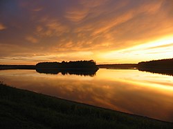
Mackenzie County is in the northwest corner of the province of Alberta. It borders the province of British Columbia to the west; the Northwest Territories to the north; Improvement District No. 24 (Wood Buffalo National Park) and the Regional Municipality of Wood Buffalo to the east; and Northern Sunrise County, the Paddle Prairie Metis Settlement, and the County of Northern Lights to the south. The Peace River meanders eastward through the southeast portion of Mackenzie County. Some of its water bodies include Bistcho Lake, Eva Lake, Margaret Lake, Wadlin Lake, Wentzel Lake, and Zama Lake. Land formations include Bootis Hill in the northwest, the Caribou Mountains in the northeast, Buffalo Head Hills in the south, Cameron Hills in the north, and Mount Watt northwest of the Town of High Level.
Communities and localities
| The following urban municipalities are surrounded by Mackenzie County. Cities none Towns High Level Rainbow Lake Villages none Summer villages none | The following hamlets are within Mackenzie County. Hamlets Fort Vermilion La Crete Zama City |
The following localities are within Mackenzie County.
Localities
| Adams Landing Assumption Blumenort Boyer Boyer River Settlement Boyer Settlement Buffalo Head Prairie Carcajou Settlement Chateh Footner Lake Fort Vermilion Settlement Habay | Hutch Lake Indian Cabins Little Red River Lutose Meander River Meander River Station Metis North Vermilion North Vermilion Settlement Slavey Creek Steen River Vermilion Chutes |
The following settlements are within Mackenzie County.
Settlements
| Boyer Footner Fort Vermilion North Vermilion | North Zama Steen River Tugate |
First Nations have the following Indian reserves within Mackenzie County.
Indian reserves
Demographics
| Year | Pop. | ±% |
|---|---|---|
| 1991 | 7,260 | — |
| 1996 | 7,980 | +9.9% |
| 2001 | 8,829 | +10.6% |
| 2006 | 10,002 | +13.3% |
| 2011 | 10,927 | +9.2% |
| 2016 | 11,171 | +2.2% |
| 2021 | 12,804 | +14.6% |
| Source: Statistics Canada |
In the 2021 Census of Population conducted by Statistics Canada, Mackenzie County had a population of 12,804 living in 3,516 of its 3,756 total private dwellings, a change of 14.6% from its 2016 population of 11,171. With a land area of 79,629.26 km2 (30,745.03 sq mi), it had a population density of 0.2/km2 (0.4/sq mi) in 2021.
The population of Mackenzie County according to its 2018 municipal census is 12,514, a change of 6.5% from its 2015 municipal census population of 11,750.
In the 2016 Census of Population conducted by Statistics Canada, Mackenzie County had a population of 11,171 living in 3,088 of its 3,567 total private dwellings, a change of 2.2% from its 2011 population of 10,927. With a land area of 80,458.19 km2 (31,065.08 sq mi), it had a population density of 0.1/km2 (0.4/sq mi) in 2016.
Attractions
Mackenzie County is home to Caribou Mountains Wildland Provincial Park and Hay-Zama Lakes Wildland Provincial Park. It is also adjacent to Wood Buffalo National Park to the east.