Paprat Peak
In-game article clicks load inline without leaving the challenge.
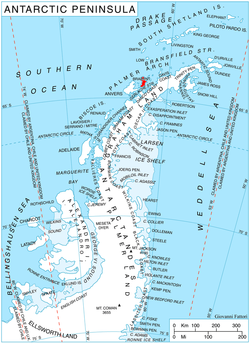
Paprat Peak (Bulgarian:връх Папрат,romanized:vrah Paprat, IPA:[ˈvrɤxˈpaprɐt]) is the ice-covered peak of elevation 549 m in Solvay Mountains on Brabant Island in the Palmer Archipelago, Antarctica. It surmounts Koch Glacier to the east, Chiriguano Bay to the south and Jenner Glacier to the northwest.
The peak is named after the settlement of Paprat in Southern Bulgaria.
Location
Paprat Peak is located at 64°26′18″S 62°31′49″W/64.43833°S 62.53028°W/ -64.43833; -62.53028, which is 3.5km east-southeast of Kondolov Peak, 4.4km south by east of Mount Aciar, 7.35km southwest of Cook Summit, 7km northwest of Cervantes Point and 6km northeast of Mount Bulcke. British mapping in 1980 and 2008.
Maps
- Scale 1:250000 topographic map of Antarctica. Scientific Committee on Antarctic Research (SCAR). Since 1993, regularly upgraded and updated.
- Scale 1:200000 topographic map. DOS 610 Series, Sheet W 64 62. Directorate of Overseas Surveys, Tolworth, UK, 1980.
- Scale 1:250000 topographic map. British Antarctic Survey, 2008.
Notes
- Antarctic Place-names Commission. (details in Bulgarian, in English)
- SCAR Composite Antarctic Gazetteer.
External links
- Copernix satellite image

This article includes information from the which is used with permission.