Pardubice District
In-game article clicks load inline without leaving the challenge.
Pardubice District (Czech: okres Pardubice) is a district in the Pardubice Region of the Czech Republic. Its capital is the city of Pardubice.
Administrative division
Pardubice District is divided into three administrative districts of municipalities with extended competence: Pardubice, Holice and Přelouč.
List of municipalities
Cities and towns are marked in bold and market towns in italics:
Barchov - Bezděkov - Borek - Brloh - Břehy - Bukovina nad Labem - Bukovina u Přelouče - Bukovka - Býšť - Časy - Čeperka - Čepí - Černá u Bohdanče - Choltice - Choteč - Chrtníky - Chvaletice - Chvojenec - Chýšť - Dašice - Dolany - Dolní Roveň - Dolní Ředice - Dříteč - Dubany - Hlavečník - Holice - Holotín - Horní Jelení - Horní Ředice - Hrobice - Jankovice - Jaroslav - Jedousov - Jeníkovice - Jezbořice - Kasalice - Kladruby nad Labem - Kojice - Kostěnice - Křičeň - Kunětice - Labské Chrčice - Lány u Dašic - Lázně Bohdaneč - Libišany - Lipoltice - Litošice - Malé Výkleky - Mikulovice - Mokošín - Morašice - Moravany - Němčice - Neratov - Opatovice nad Labem - Ostřešany - Ostřetín - Pardubice - Plch - Poběžovice u Holic - Poběžovice u Přelouče - Podůlšany - Pravy - Přelouč - Přelovice - Přepychy - Ráby - Řečany nad Labem - Rohovládova Bělá - Rohoznice - Rokytno - Rybitví - Selmice - Semín - Sezemice - Slepotice - Sopřeč - Sovolusky - Spojil - Srch - Srnojedy - Staré Hradiště - Staré Jesenčany - Staré Ždánice - Starý Mateřov - Stéblová - Stojice - Strašov - Svinčany - Svojšice - Tetov - Trnávka - Trusnov - Třebosice - Turkovice - Uhersko - Úhřetická Lhota - Újezd u Přelouče - Újezd u Sezemic - Urbanice - Valy - Vápno - Veliny - Veselí - Vlčí Habřina - Voleč - Vysoké Chvojno - Vyšehněvice - Žáravice - Zdechovice - Živanice
Geography
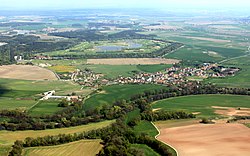
The terrain is mostly flat and belongs to the Polabí region. The territory extends into four geomorphological mesoregions: East Elbe Table (most of the territory), Svitavy Uplands (south), Orlice Table (east), and Iron Mountains (southwest). The highest point of the district is a contour line in Holotín with an elevation of 398 m (1,306 ft), the lowest point is the river bed of the Elbe in Kojice at 201 m (659 ft).
From the total district area of 880.2 km2 (339.8 sq mi), agricultural land occupies 521.4 km2 (201.3 sq mi), forests occupy 222.2 km2 (85.8 sq mi), and water area occupies 27.1 km2 (10.5 sq mi). Forests cover 25.2% of the district's area.
The most important river is the Elbe, which flows across the district from northeast to west. Its largest tributaries within the district are the Chrudimka and Loučná. There are relatively many bodies of water in the area, which are not only ponds, but also artificial lakes created by flooding gravel quarries. The largest body of water is Bohdanečský Pond with an area of 160 ha (400 acres).
There are no large-scale protected areas.
Demographics
| Year | Pop. | ±% |
|---|---|---|
| Historical population | ||
| YearPop.±%186981,208—188090,778+11.8%189094,467+4.1%190099,973+5.8%1910110,095+10.1% | YearPop.±%1921113,000+2.6%1930119,905+6.1%1950118,008−1.6%1961138,579+17.4%1970149,563+7.9% | YearPop.±%1980163,271+9.2%1991162,772−0.3%2001160,658−1.3%2011168,423+4.8%2021173,206+2.8% |
| 1869 | 81,208 | — |
| 1880 | 90,778 | +11.8% |
| 1890 | 94,467 | +4.1% |
| 1900 | 99,973 | +5.8% |
| 1910 | 110,095 | +10.1% |
| Year | Pop. | ±% |
| 1921 | 113,000 | +2.6% |
| 1930 | 119,905 | +6.1% |
| 1950 | 118,008 | −1.6% |
| 1961 | 138,579 | +17.4% |
| 1970 | 149,563 | +7.9% |
| Year | Pop. | ±% |
| 1980 | 163,271 | +9.2% |
| 1991 | 162,772 | −0.3% |
| 2001 | 160,658 | −1.3% |
| 2011 | 168,423 | +4.8% |
| 2021 | 173,206 | +2.8% |
| Source: Censuses |
Most populated municipalities
| Name | Population | Area (km2) |
|---|---|---|
| Pardubice | 92,319 | 83 |
| Přelouč | 10,203 | 30 |
| Holice | 6,761 | 20 |
| Sezemice | 4,451 | 22 |
| Lázně Bohdaneč | 3,355 | 22 |
| Chvaletice | 2,925 | 9 |
| Opatovice nad Labem | 2,912 | 12 |
| Dašice | 2,692 | 18 |
| Staré Hradiště | 2,124 | 9 |
| Dolní Roveň | 2,116 | 29 |
Economy
The largest employers with headquarters in Pardubice District and at least 1,000 employees are:
| Economic entity | Location | Number of employees | Main activity |
|---|---|---|---|
| Regional Hospital Pardubice | Pardubice | 5,000–9,999 | Health care |
| JIP východočeská | Pardubice | 2,000–2,499 | Wholesale trade |
| Panasonic Automotive Systems Czech | Pardubice | 1,500–1,999 | Manufacture of electronic components |
| Regional Police Directorate of the Pardubice Region | Pardubice | 1,500–1,999 | Public order and safety activities |
| University of Pardubice | Pardubice | 1,500–1,999 | Education |
| Kiekert-CS | Přelouč | 1,500–1,999 | Manufacture of lock systems for automotive industry |
| Foxconn CZ | Pardubice | 1,000–1,499 | Manufacture of components for computers |
| Foxconn European Manufacturing Services | Pardubice | 1,000–1,499 | Manufacture of components for computers |
| Synthesia | Pardubice | 1,000–1,499 | Chemical industry |
Transport
The D11 motorway from Prague to Hradec Králové (part of the European route E67) runs along the northern district border. The D35 motorway (European route E442) separates from the D11, which runs across the eastern part of the district and, after its completion, will connect the district with Olomouc.
Pardubice Airport is located in the district. It is one of the six public international airports in the country.
Sights

The Landscape for Breeding and Training of Ceremonial Carriage Horses at Kladruby nad Labem was designated a UNESCO World Heritage Site in 2019 because it is a unique example of a cultural landscape designed to effectively breed and train the Kladruber horses and demonstrates an outstanding example of the ferme ornée style of landscape architecture.
The most important monuments in the district, protected as national cultural monuments, are:
- Zámeček reverent area in Pardubice
- National Stud Farm in Kladruby nad Labem
- Kunětická hora Castle
- Pardubice Castle
- Pardubice Crematorium
- Winternitz automatic mills in Pardubice
- Larisch Villa in Pardubice
The best-preserved settlements and landscapes, protected as monument reservations and monument zones, are:
The most visited tourist destinations are the Museum of East Bohemia in Pardubice and National Stud Farm in Kladruby nad Labem.
Notable people
External links
- – profile on the Czech Statistical Office website