List of airports in the Northwest Territories
In-game article clicks load inline without leaving the challenge.
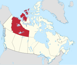
This is a list of airports in the Northwest Territories. It includes all Nav Canada certified and registered water and land airports, aerodromes and heliports in the Canadian territory of the Northwest Territories. Airport names in italics are part of the National Airports System.
List of airports and heliports
The list is sorted by the name of the community served; click the sort buttons in the table header to switch listing order.
| Community | Airport name | PU PR MI | AOE | Operator | Elevation | ICAO | TC LID | IATA | Image | Coordinates |
|---|---|---|---|---|---|---|---|---|---|---|
| Aklavik | Aklavik/Freddie Carmichael Airport | PU | Govt of Northwest Territories | 21 ft (6.4 m) | CYKD | LAK | 68°13′24″N 135°00′21″W/68.22333°N 135.00583°W/ 68.22333; -135.00583(Aklavik/Freddie Carmichael Airport) | |||
| Aklavik | Aklavik Water Aerodrome | PU | K & D Contracting | 7 ft (2.1 m) | CER6 | 68°13′21″N 134°59′30″W/68.22250°N 134.99167°W/ 68.22250; -134.99167(Aklavik Water Aerodrome) | ||||
| Behchokǫ̀ | Rae/Edzo Airport | PU | Til Cho Construction | 587 ft (179 m) | CRE2 | 62°46′00″N 116°05′01″W/62.76667°N 116.08361°W/ 62.76667; -116.08361(Rae/Edzo Airport) | ||||
| Colville Lake | Colville Lake/Tommy Kochon Aerodrome | PU | Govt of Northwest Territories | 899 ft (274 m) | CYVL | YCK | 67°02′00″N 126°05′00″W/67.03333°N 126.08333°W/ 67.03333; -126.08333(Colville Lake Airport) | |||
| Colville Lake | Colville Lake Water Aerodrome | PU | Kapami Co-op Association | 801 ft (244 m) | CED7 | 67°02′29″N 126°06′02″W/67.04139°N 126.10056°W/ 67.04139; -126.10056(Colville Lake Water Aerodrome) | ||||
| Délı̨nę | Déline Airport | PU | Govt of Northwest Territories | 702 ft (214 m) | CYWJ | YWJ | 65°12′40″N 123°26′11″W/65.21111°N 123.43639°W/ 65.21111; -123.43639(Déline Airport) | |||
| Délı̨nę | Déline Water Aerodrome | PU | Charter Community of Déline | 512 ft (156 m) | CEN7 | 65°11′00″N 123°25′00″W/65.18333°N 123.41667°W/ 65.18333; -123.41667(Déline Water Aerodrome) | ||||
| Diavik Diamond Mine | Diavik Airport | PR | Diavik Diamond Mines | 1,416 ft (432 m) | CDK2 | 64°30′41″N 110°17′22″W/64.51139°N 110.28944°W/ 64.51139; -110.28944(Diavik Airport) | ||||
| Ekati Diamond Mine | Ekati Airport | PR | Arctic Canadian Diamond Company | 1,536 ft (468 m) | CYOA | YOA | 64°41′56″N 110°36′53″W/64.69889°N 110.61472°W/ 64.69889; -110.61472(Ekati Airport) | |||
| Ford Bay, Great Bear Lake | Ford Bay Airport | PR | Trophy Lodge | 673 ft (205 m) | CBC2 | 66°02′15″N 124°42′54″W/66.03750°N 124.71500°W/ 66.03750; -124.71500(Ford Bay Airport) | ||||
| Ford Bay, Great Bear Lake | Ford Bay Water Aerodrome | PR | Trophy Lodge | 512 ft (156 m) | CEL7 | 66°02′00″N 124°41′00″W/66.03333°N 124.68333°W/ 66.03333; -124.68333(Ford Bay Water Aerodrome) | ||||
| Fort Good Hope | Fort Good Hope Airport | PU | Govt of Northwest Territories | 267 ft (81 m) | CYGH | YGH | 66°14′27″N 128°39′03″W/66.24083°N 128.65083°W/ 66.24083; -128.65083(Fort Good Hope Airport) | |||
| Fort Liard | Fort Liard Airport | PU | Govt of Northwest Territories | 708 ft (216 m) | CYJF | YJF | 60°14′08″N 123°28′12″W/60.23556°N 123.47000°W/ 60.23556; -123.47000(Fort Liard Airport) | |||
| Fort McPherson | Fort McPherson Airport | PU | Govt of Northwest Territories | 115 ft (35 m) | CZFM | ZFM | 67°24′27″N 134°51′38″W/67.40750°N 134.86056°W/ 67.40750; -134.86056(Fort McPherson Airport) | |||
| Fort Providence | Fort Providence Airport | PU | Govt of Northwest Territories | 525 ft (160 m) | CYJP | 61°19′09″N 117°36′22″W/61.31917°N 117.60611°W/ 61.31917; -117.60611(Fort Providence Airport) | ||||
| Fort Reliance | Fort Reliance Water Aerodrome | PU | Lutselk'e Dene Council | 514 ft (157 m) | CJN8 | 62°42′00″N 109°10′00″W/62.70000°N 109.16667°W/ 62.70000; -109.16667(Fort Reliance Water Aerodrome) | ||||
| Fort Resolution | Fort Resolution Airport | PU | Govt of Northwest Territories | 527 ft (161 m) | CYFR | YFR | 61°10′51″N 113°41′23″W/61.18083°N 113.68972°W/ 61.18083; -113.68972(Fort Resolution Airport) | |||
| Fort Simpson | Fort Simpson Airport | PU | Govt of Northwest Territories | 556 ft (169 m) | CYFS | YFS | 61°45′37″N 121°14′11″W/61.76028°N 121.23639°W/ 61.76028; -121.23639(Fort Simpson Airport) | |||
| Fort Simpson | Fort Simpson (Great Slave No. 1) Heliport | PR | Govt of Northwest Territories | 500 ft (150 m) | CFS2 | 61°50′18″N 121°19′35″W/61.83833°N 121.32639°W/ 61.83833; -121.32639(Fort Simpson/(Great Slave No. 1) Heliport) | ||||
| Fort Simpson | Fort Simpson (Great Slave No. 2) Heliport | PR | Govt of Northwest Territories | 48 ft (15 m) | CFD8 | 61°50′12″N 121°19′30″W/61.83667°N 121.32500°W/ 61.83667; -121.32500(Fort Simpson/(Great Slave No. 2) Heliport) | ||||
| Fort Simpson | Fort Simpson Island Airport | PR | Simpson Air South Nahanni Airways | 405 ft (123 m) | CET4 | 61°52′00″N 121°21′58″W/61.86667°N 121.36611°W/ 61.86667; -121.36611(Fort Simpson Island Airport) | ||||
| Fort Simpson | Fort Simpson Island Water Aerodrome | PR | Wolverine Air / Simpson Air | 375 ft (114 m) | CEZ7 | 61°52′00″N 121°22′00″W/61.86667°N 121.36667°W/ 61.86667; -121.36667(Fort Simpson Island Water Aerodrome) | ||||
| Fort Smith | Fort Smith Airport | PU | Govt of Northwest Territories | 673 ft (205 m) | CYSM | YSM | 60°01′13″N 111°57′43″W/60.02028°N 111.96194°W/ 60.02028; -111.96194(Fort Smith Airport) | |||
| Fort Smith | Fort Smith (District) Heliport | PR | Department of Environment & Climate Change, Govt of Northwest Territories | 665 ft (203 m) | CEC5 | 60°00′11″N 111°54′34″W/60.00306°N 111.90944°W/ 60.00306; -111.90944(Fort Smith (District) Heliport) | ||||
| Frank Channel | Frank Channel (Forestry) Heliport | PR | Department of Environment & Climate Change, Govt of Northwest Territories | 520 ft (160 m) | CFB2 | 62°47′10″N 115°56′45″W/62.78611°N 115.94583°W/ 62.78611; -115.94583(Frank Channel (Forestry) Heliport) | ||||
| Gahcho Kue Diamond Mine | Gahcho Kue Aerodrome | PR | De Beers Canada | 1,429 ft (436 m) | CGK2 | 63°26′07″N 109°08′41″W/63.43528°N 109.14472°W/ 63.43528; -109.14472(Gahcho Kue Aerodrome) | ||||
| Gamèti | Gamètì/Rae Lakes Airport | PU | Govt of Northwest Territories | 724 ft (221 m) | CYRA | YRA | 64°06′58″N 117°18′35″W/64.11611°N 117.30972°W/ 64.11611; -117.30972(Gamètì/Rae Lakes Airport) | |||
| Graham Lake | Graham Lake (Yellow Dog Lodge) Water Aerodrome | PR | Yellow Dog Lodge | 725 ft (221 m) | CYD2 | 62°53′28″N 113°52′04″W/62.89111°N 113.86778°W/ 62.89111; -113.86778(Graham Lake (Yellow Dog Lodge) Water Aerodrome) | ||||
| Great Bear Lake | Great Bear Lake Airport | PR | Plummers Great Bear Lake Lodge | 551 ft (168 m) | CFF4 | DAS | 66°42′11″N 119°43′02″W/66.70306°N 119.71722°W/ 66.70306; -119.71722(Great Bear Lake Airport) | |||
| Great Bear Lake | Great Bear Lake Water Aerodrome | PU | Plummers Great Bear Lake Lodge | 512 ft (156 m) | CES9 | 66°42′30″N 119°41′00″W/66.70833°N 119.68333°W/ 66.70833; -119.68333(Great Bear Lake Water Aerodrome) | ||||
| Great Slave Lake | Taltheilei Narrows Airport | PR | Plummers Great Slave Lake Lodge | 617 ft (188 m) | CFA7 | 62°35′50″N 111°32′28″W/62.59722°N 111.54111°W/ 62.59722; -111.54111(Taltheilei Narrows Airport) | ||||
| Great Slave Lake | Taltheilei Narrows Water Aerodrome | PR | Plummers Great Slave Lake Lodge | 514 ft (157 m) | CED9 | 62°36′00″N 111°31′00″W/62.60000°N 111.51667°W/ 62.60000; -111.51667(Taltheilei Narrows Water Aerodrome) | ||||
| Hay River | Hay River/Merlyn Carter Airport | PU | Govt of Northwest Territories | 541 ft (165 m) | CYHY | YHY | 60°50′23″N 115°46′58″W/60.83972°N 115.78278°W/ 60.83972; -115.78278(Hay River/Merlyn Carter Airport) | |||
| Hay River | Hay River (District) Heliport | PR | Department of Environment & Natural Resources, Govt of Northwest Territories | 550 ft (170 m) | CET5 | 60°47′04″N 115°49′33″W/60.78444°N 115.82583°W/ 60.78444; -115.82583(Hay River (District) Heliport) | ||||
| Hay River | Hay River Water Aerodrome | PR | Carter Air Service | 514 ft (157 m) | CEF8 | 60°51′07″N 115°43′50″W/60.85194°N 115.73056°W/ 60.85194; -115.73056(Hay River Water Aerodrome) | ||||
| Inuvik | Inuvik (Mike Zubko) Airport | PU | 15 | Govt of Northwest Territories | 223 ft (68 m) | CYEV | YEV | 68°18′14″N 133°28′59″W/68.30389°N 133.48306°W/ 68.30389; -133.48306(Inuvik (Mike Zubko) Airport) | ||
| Inuvik | Inuvik/Shell Lake Water Aerodrome | PU | 15 | North-Wright Airways | 57 ft (17 m) | CEE3 | 68°19′28″N 133°38′04″W/68.32444°N 133.63444°W/ 68.32444; -133.63444(Inuvik/Shell Lake Water Aerodrome) | |||
| Jean Marie River | Jean Marie River Airport | PU | Govt of Northwest Territories | 457 ft (139 m) | CET9 | 61°31′21″N 120°37′30″W/61.52250°N 120.62500°W/ 61.52250; -120.62500(Jean Marie River Airport) | ||||
| Kasba Lake | Kasba Lake Airport | PR | Kasba Lake Lodge | 1,143 ft (348 m) | CJL8 | 60°17′27″N 102°30′11″W/60.29083°N 102.50306°W/ 60.29083; -102.50306(Kasba Lake Airport) | ||||
| Kasba Lake | Kasba Lake Water Aerodrome | PR | Kasba Lake Lodge | 1,089 ft (332 m) | CJP5 | 60°17′00″N 102°31′00″W/60.28333°N 102.51667°W/ 60.28333; -102.51667(Kasba Lake Water Aerodrome) | ||||
| Łutselk'e | Lutselk'e Airport | PU | Govt of Northwest Territories | 586 ft (179 m) | CYLK | 62°25′06″N 110°40′56″W/62.41833°N 110.68222°W/ 62.41833; -110.68222(Lutselk'e Airport) | ||||
| Łutselk'e | Lutselk'e Water Aerodrome | PU | Łutselk'e Dene Council | 514 ft (157 m) | CEB9 | 62°24′00″N 110°45′00″W/62.40000°N 110.75000°W/ 62.40000; -110.75000(Lutselk'e Water Aerodrome) | ||||
| Nahanni Butte | Nahanni Butte Airport | PU | Govt of Northwest Territories | 598 ft (182 m) | CBD6 | 61°01′47″N 123°23′20″W/61.02972°N 123.38889°W/ 61.02972; -123.38889(Nahanni Butte Airport) | ||||
| Nahanni National Park Reserve | Náįlįcho Water Aerodrome | PR | Nahanni National Park Reserve | 2,200 ft (670 m) | CFV5 | 61°36′27″N 125°45′24″W/61.60750°N 125.75667°W/ 61.60750; -125.75667(Náįlįcho Water Aerodrome) | ||||
| Namushka Lodge (Harding Lake) | Namushka Lodge Water Aerodrome | PR | Namuska Lodge | 670 ft (200 m) | CEP9 | 62°25′00″N 113°21′00″W/62.41667°N 113.35000°W/ 62.41667; -113.35000(Namushka Lodge Water Aerodrome) | ||||
| Norman Wells | Norman Wells Airport | PU | Govt of Northwest Territories | 237 ft (72 m) | CYVQ | YVQ | 65°16′54″N 126°47′54″W/65.28167°N 126.79833°W/ 65.28167; -126.79833(Norman Wells Airport) | |||
| Norman Wells | Norman Wells Water Aerodrome | PR | Northwright Air Ltd. | 200 ft (61 m) | CEU8 | 65°15′29″N 126°41′29″W/65.25806°N 126.69139°W/ 65.25806; -126.69139(Norman Wells Water Aerodrome) | ||||
| North of Sixty Fishing Camps | Obre Lake/North of Sixty Airport | PR | North of Sixty Fishing Camps | 1,202 ft (366 m) | CKV4 | YDW | 60°18′56″N 103°07′54″W/60.31556°N 103.13167°W/ 60.31556; -103.13167(Obre Lake/North of Sixty Airport) | |||
| North of Sixty Fishing Camps | Obre Lake/North of Sixty Water Aerodrome | PR | North of Sixty Fishing Camps | 1,150 ft (350 m) | CKP8 | 60°19′13″N 103°07′36″W/60.32028°N 103.12667°W/ 60.32028; -103.12667(Obre Lake/North of Sixty Water Aerodrome) | ||||
| Paulatuk | Paulatuk (Nora Aliqatchialuk Ruben) Airport | PU | Govt of Northwest Territories | 15 ft (4.6 m) | CYPC | YPC | 69°21′38″N 124°04′33″W/69.36056°N 124.07583°W/ 69.36056; -124.07583(Paulatuk (Nora Aliqatchialuk Ruben) Airport) | |||
| Paulatuk | Paulatuk Water Aerodrome | PU | Hamlet | 0 ft (0 m) | CEW8 | 69°21′00″N 124°04′00″W/69.35000°N 124.06667°W/ 69.35000; -124.06667(Paulatuk Water Aerodrome) | ||||
| Prairie Creek | Prairie Creek Airport | PR | Canadian Zinc Corp. | 2,950 ft (900 m) | CBH4 | 61°33′53″N 124°48′54″W/61.56472°N 124.81500°W/ 61.56472; -124.81500(Prairie Creek Airport) | ||||
| Sachs Harbour | Sachs Harbour (David Nasogaluak Jr. Saaryuaq) Airport | PU | Govt of Northwest Territories | 283 ft (86 m) | CYSY | YSY | 71°59′38″N 125°14′33″W/71.99389°N 125.24250°W/ 71.99389; -125.24250(Sachs Harbour Airport) | |||
| Sambaa K'e | Sambaa K'e Aerodrome | PU | Govt of Northwest Territories | 1,666 ft (508 m) | CEU9 | 60°25′25″N 121°16′11″W/60.42361°N 121.26972°W/ 60.42361; -121.26972(Sambaa K'e Aerodrome) | ||||
| Sambaa K'e | Sambaa K'e Water Aerodrome | PU | Sambaa K'e First Nation | 1,623 ft (495 m) | CEG9 | 60°26′32″N 121°14′10″W/60.44222°N 121.23611°W/ 60.44222; -121.23611(Sambaa K'e Water Aerodrome) | ||||
| Snare River | Snare River Airport | PR | Northwest Territories Power Corporation | 700 ft (210 m) | CEV9 | 63°26′00″N 116°11′00″W/63.43333°N 116.18333°W/ 63.43333; -116.18333(Snare River Airport) | ||||
| Taltson River | Taltson River Airport | PR | Northwest Territories Power Corporation | 875 ft (267 m) | CFW5 | 60°23′39″N 111°20′50″W/60.39417°N 111.34722°W/ 60.39417; -111.34722(Taltson River Airport) | ||||
| Tuktoyaktuk | Tuktoyaktuk/James Gruben Airport | PU | 15 | Govt of Northwest Territories | 14 ft (4.3 m) | CYUB | YUB | 69°26′00″N 133°01′35″W/69.43333°N 133.02639°W/ 69.43333; -133.02639(Tuktoyaktuk/James Gruben Airport) | ||
| Tulita | Tulita Airport | PU | Govt of Northwest Territories | 329 ft (100 m) | CZFN | ZFN | 64°54′35″N 125°34′21″W/64.90972°N 125.57250°W/ 64.90972; -125.57250(Tulita Airport) | |||
| Tundra Mine / Salmita Mine | Tundra Mine/Salamita [sic] Mine Aerodrome | PR | Indigenous and Northern Affairs Canada | 1,382 ft (421 m) | CTM7 | 64°04′22″N 111°09′48″W/64.07278°N 111.16333°W/ 64.07278; -111.16333(Tundra Mine/Salamita Mine Aerodrome) | ||||
| Tungsten | Tungsten (Cantung) Airport | PR | North American Tungsten Corp | 3,651 ft (1,113 m) | CBX5 | 61°57′25″N 128°12′10″W/61.95694°N 128.20278°W/ 61.95694; -128.20278(Tungsten (Cantung) Airport) | ||||
| Ulukhaktok | Ulukhaktok Airport | PU | Govt of Northwest Territories | 118 ft (36 m) | CYHI | YHI | 70°45′46″N 117°48′22″W/70.76278°N 117.80611°W/ 70.76278; -117.80611(Ulukhaktok Airport) | |||
| Wekweètì | Wekweètì Airport | PU | Govt of Northwest Territories | 1,208 ft (368 m) | CYWE | 64°11′27″N 114°04′36″W/64.19083°N 114.07667°W/ 64.19083; -114.07667(Wekweètì Airport) | ||||
| Whatì | Whatì Airport | PU | Govt of Northwest Territories | 882 ft (269 m) | CEM3 | 63°07′54″N 117°14′46″W/63.13167°N 117.24611°W/ 63.13167; -117.24611(Whatì Airport) | ||||
| Whatì | Whatì Water Aerodrome | PU | Whatì Hamlet | 870 ft (270 m) | CEQ8 | 63°09′00″N 117°16′00″W/63.15000°N 117.26667°W/ 63.15000; -117.26667(Whatì Water Aerodrome) | ||||
| Wrigley | Wrigley Airport | PU | Govt of Northwest Territories | 490 ft (150 m) | CYWY | YWY | 63°12′34″N 123°26′12″W/63.20944°N 123.43667°W/ 63.20944; -123.43667(Wrigley Airport) | |||
| Yellowknife | Yellowknife Airport | PU | 15 | Govt of Northwest Territories | 675 ft (206 m) | CYZF | YZF | 62°27′46″N 114°26′25″W/62.46278°N 114.44028°W/ 62.46278; -114.44028(Yellowknife Airport) | ||
| Yellowknife | Yellowknife Water Aerodrome | PU | Ahmic Air Air Tindi | 514 ft (157 m) | CEN9 | 62°28′00″N 114°21′00″W/62.46667°N 114.35000°W/ 62.46667; -114.35000(Yellowknife Water Aerodrome) |
Defunct airports

| Community | Airport name | ICAO | TC LID | IATA | Coordinates |
|---|---|---|---|---|---|
| Colomac Mine | Colomac Airport | CFY8 | 64°23′06″N 115°07′29″W/64.38500°N 115.12472°W/ 64.38500; -115.12472(Colomac Airport (defunct)) | ||
| Fort McPherson | Fort McPherson Water Aerodrome | CEU7 | 67°27′00″N 134°53′00″W/67.45000°N 134.88333°W/ 67.45000; -134.88333(Fort McPherson Water Aerodrome (defunct)) | ||
| Fort Providence | Fort Providence Water Aerodrome | CEX7 | 61°21′00″N 117°40′00″W/61.35000°N 117.66667°W/ 61.35000; -117.66667(Fort Providence Water Aerodrome (defunct)) | ||
| Fort Smith | Fitzgerald (Fort Smith) Water Aerodrome | CEJ7 | 59°51′00″N 111°36′00″W/59.85000°N 111.60000°W/ 59.85000; -111.60000(Fitzgerald (Fort Smith) Water Aerodrome (defunct)) | ||
| Hay River | Hay River/Brabant Lodge Water Aerodrome | CEA8 | 61°03′00″N 116°36′00″W/61.05000°N 116.60000°W/ 61.05000; -116.60000(Hay River/Brabant Lodge Water Aerodrome (defunct)) | ||
| Nahanni Butte | Nahanni Butte Water Aerodrome | CET8 | 61°02′00″N 123°21′00″W/61.03333°N 123.35000°W/ 61.03333; -123.35000(Nahanni Butte Water Aerodrome (defunct)) | ||
| Prince Patrick Island | Mould Bay Airport | YMD | 76°14′21″N 119°19′07″W/76.23917°N 119.31861°W/ 76.23917; -119.31861(Mould Bay Airport (defunct)) | ||
| Snap Lake Diamond Mine | Snap Lake Airport | CSK6 | 63°35′37″N 110°54′20″W/63.59361°N 110.90556°W/ 63.59361; -110.90556(Snap Lake Airport (defunct)) | ||
| Thor Lake | Thor Lake Aerodrome | CYMD | CTH2 | 62°06′03″N 112°37′32″W/62.10083°N 112.62556°W/ 62.10083; -112.62556(Thor Lake Aerodrome (defunct)) | |
| Tsiigehtchic | Arctic Red River Water Aerodrome | CES6 | 67°27′00″N 133°45′00″W/67.45000°N 133.75000°W/ 67.45000; -133.75000(Arctic Red River Water Aerodrome (defunct)) |